 Cycle Maps
Cycling routes and mountain-bike trails in Hamburg
Cycle Maps lists cycling routes and mountain-bike trails as tracks. 4 rides Hamburg is known for, then 18 other tracks within 16 km of the centre of Hamburg, Germany, longest first.
- 22 tracks
- 99.6 km (61.9 mi) the longest
- 497.6 km (309.2 mi) in all

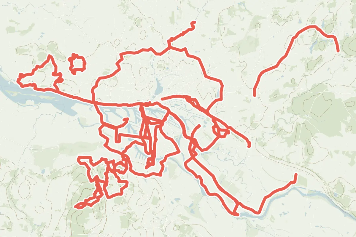
First come rides Hamburg is known for: Elbuferradweg, 16.7 km (10.4 mi); 2. Grüner Ring, a loop of 99.6 km (61.9 mi); Radweg "Vier und Marschlande", 29.7 km (18.5 mi); and Elberadweg rechtselbisch, Abschnitt C, 43.4 km (27.0 mi) from Wedel to Kirchwerder. Of the 18 other tracks around the centre, 15 are for cycling and 3 for mountain bikes. The longest ride or track here is 2. Grüner Ring, 99.6 km (61.9 mi). 4 of them end where they start. Radroute 03 runs through the centre itself. Most of them lie south of the centre. Of those of 5 km or more, the hilliest is Tour 10, Radwanderweg, Stormarn, with about 240 m of climb over 67.8 km (42.1 mi), and the flattest Veloroute 10, with almost none. 4 long-distance routes pass through as well: EuroVelo 3 - La Route des Pèlerins, EuroVelo 12 - North Sea Cycle Route, Pilgerroute and Nordseeküstenroute.
How people ride in Germany: a typical ride in Germany was 8.3 km (5.2 mi), at 16.0 km/h (10 mph) while moving, from the rides of 602 Cycle Maps riders in 2014–2022.
How long
- 1 under 5 km (3 mi)
- 14 of 5 to 20 km (3 to 12 mi)
- 7 over 20 km (12 mi)
How hilly
- Flat 15
- Rolling 4
- Hilly 2
By each one’s climb per kilometre: flat under 5 m (26 ft a mile), hilly from 15 m (79 ft a mile). Most climbs are estimated.
Popular rides in Hamburg
Chosen by Cycle Maps among the tracks mapped in OpenStreetMap: rides Hamburg is known for.
- Elbuferradweg Cycling track Rolling 16.7 km (10.4 mi) About 120 m (390 ft) of climb · 1.7 km (1.1 mi) from the centre
- 2. Grüner Ring Cycling track Flat 99.6 km (61.9 mi) Loop · About 230 m (750 ft) of climb · 2.9 km (1.8 mi) from the centre
- Radweg "Vier und Marschlande" Cycling track Flat 29.7 km (18.5 mi) About 10 m (30 ft) of climb · 4.1 km (2.5 mi) from the centre
- Elberadweg rechtselbisch, Abschnitt C (D10) Cycling track Flat 43.4 km (27.0 mi) Wedel to Kirchwerder · About 160 m (520 ft) of climb · 566 m (1,857 ft) from the centre
On the map
Each line is a track; tap one for its name.
Other tracks around Hamburg
- Tour 10, Radwanderweg, Stormarn Cycling track Flat 67.8 km (42.1 mi) About 240 m (790 ft) of climb · 15.0 km (9.3 mi) from the centre
- Hafenerlebnisroute Cycling track Flat 31.7 km (19.7 mi) About 20 m (70 ft) of climb · 1.9 km (1.2 mi) from the centre
- Radroute 02 Cycling track Flat 29.5 km (18.3 mi) Eidelstedt to Bergedorf · About 60 m (200 ft) of climb · 681 m (2,234 ft) from the centre
- Elbkieker Tour Cycling track Flat 21.7 km (13.5 mi) Loop · Almost flat · 7.6 km (4.7 mi) from the centre
- Veloroute 11 Cycling track Flat 17.9 km (11.1 mi) City to Eißendorf · About 40 m (130 ft) of climb · 1.9 km (1.2 mi) from the centre
- Hamburg Veloroute 8 Cycling track Flat 17.2 km (10.7 mi) About 70 m (230 ft) of climb · 1.3 km (0.8 mi) from the centre
- Mountainbike-Tour M1 Rosengarten Mountain-bike track Rolling 14.7 km (9.1 mi) Loop · About 170 m (560 ft) of climb · 14.8 km (9.2 mi) from the centre
- Alter Elbtunnel Cycling track Flat 13.2 km (8.2 mi) About 60 m (200 ft) of climb · 2.1 km (1.3 mi) from the centre
- Radroute 03 Cycling track Flat 12.6 km (7.8 mi) Niendorf to HH-Zentrum · About 40 m (130 ft) of climb · through the centre
- Mountainbike-Tour M2 Harburger Berge Mountain-bike track Hilly 12.5 km (7.8 mi) Loop · About 230 m (750 ft) of climb · 10.3 km (6.4 mi) from the centre
- Tour hinter den Deichen Cycling track Flat 12.4 km (7.7 mi) Loop · Almost flat · 7.6 km (4.7 mi) from the centre
- Billeradweg Cycling track Flat 12.2 km (7.6 mi) About 20 m (70 ft) of climb · 2.1 km (1.3 mi) from the centre
- Elbbrücken Cycling track Flat 10.8 km (6.7 mi) About 20 m (70 ft) of climb · 2.9 km (1.8 mi) from the centre
- Radroute 07 Cycling track Rolling 10.0 km (6.2 mi) Wandsbek to Altona · About 50 m (160 ft) of climb · through the centre
- Veloroute 10 Cycling track Flat 9.5 km (5.9 mi) Almost flat · 2.9 km (1.8 mi) from the centre
- Radroute 01 Cycling track Rolling 7.7 km (4.8 mi) Ottensen to St. Georg · About 50 m (160 ft) of climb · through the centre
- Mountainbike-Tour M3 Rosengarten-Harburger Berge Mountain-bike track Hilly 5.6 km (3.5 mi) About 110 m (360 ft) of climb · 12.1 km (7.5 mi) from the centre
- Hamburg Veloroute 12 Cycling track 1.3 km (0.8 mi) About 10 m (30 ft) of climb · 633 m (2,077 ft) from the centre
Long-distance routes through Hamburg
Lengths and climbs are for the whole route. A route made of other routes that states no length has none here: measured, it would count its variants too.
- EuroVelo 3 - La Route des Pèlerins (EV3) International, cycling · no length stated · on OpenStreetMap About 581 m (1,906 ft) from the centre
- EuroVelo 12 - North Sea Cycle Route (EV12) International, cycling 7,250.0 km (4,504.9 mi) · on OpenStreetMap About 2.6 km (1.6 mi) from the centre OpenStreetMap: “The North Sea Cycle Route will surprise you with its diversity: from land located below sea level (the Netherlands) to cliffs over 1,000m in height (Norway). Expect to be pleasantly surprised along this popular cycle tourist track.”
- Pilgerroute (D7) National, cycling 1,065.0 km (661.8 mi) · on OpenStreetMap Aachen to Flensburg · about 567 m (1,860 ft) from the centre
- Nordseeküstenroute (D1) National, cycling · no length stated · on OpenStreetMap About 1.7 km (1.1 mi) from the centre
About this list
OpenStreetMap has 101 tracks in or near the square searched around Hamburg; this page shows 4 popular rides, 18 tracks and 4 long-distance routes. One track shorter than 1 km is left out. The centre is taken as 53.5511° N, 9.9937° E, and the list was made on 24 October 2026. How the city lists are made.
Cities near Hamburg
- Lübeck Germany · 57 km (36 mi) away
- Bremen Germany · 95 km (59 mi) away
- Hanover Germany · 132 km (82 mi) away
- Münster Germany · 238 km (148 mi) away
- Potsdam Germany · 243 km (151 mi) away
Find tracks anywhere with the app
Cycle Maps is an Android app that finds cycling and mountain-bike tracks near any spot on the map.