 Cycle Maps
Cycling routes in Potsdam
Cycle Maps lists cycling routes as tracks. 3 rides Potsdam is known for, then 21 other tracks within 16 km of the centre of Potsdam, Germany, longest first.
- 24 tracks
- 68.4 km (42.5 mi) the longest
- 543.8 km (337.9 mi) in all

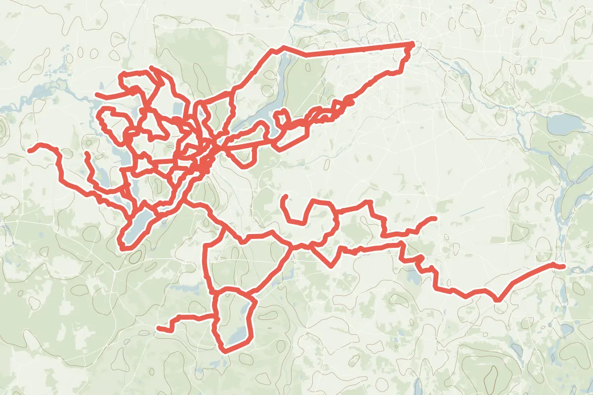
First come rides Potsdam is known for: Alter Fritz, a loop of 16.4 km (10.2 mi); F1 - Rund um den Schwielowsee, a loop of 32.7 km (20.3 mi); and Fontane.Rad Hauptroute - 8. Etappe, 18.9 km (11.8 mi) from Werder (Havel) to Potsdam. The longest ride or track here is Ernst-von-Stubenrauch-Weg, 68.4 km (42.5 mi). 11 of them end where they start. Ernst-von-Stubenrauch-Weg runs through the centre itself. Of those of 5 km or more, the hilliest is Ernst-von-Stubenrauch-Weg, with about 210 m of climb over 68.4 km (42.5 mi), and the flattest Radroute F3.2, with about 20 m. 5 long-distance routes pass through as well: Europaradweg R1, EuroVelo 2 - Hauptstadt-Route - Teil Deutschland, EuroVelo 7 - Solrute, Europaroute (D-Route 3) and Radweg D11: Ostsee <> Oberbayern.
How people ride in Germany: a typical ride in Germany was 8.3 km (5.2 mi), at 16.0 km/h (10 mph) while moving, from the rides of 602 Cycle Maps riders in 2014–2022.
How long
- 13 of 5 to 20 km (3 to 12 mi)
- 11 over 20 km (12 mi)
How hilly
- Flat 20
- Rolling 4
By each one’s climb per kilometre: flat under 5 m (26 ft a mile), hilly from 15 m (79 ft a mile). Most climbs are estimated.
Popular rides in Potsdam
Chosen by Cycle Maps among the tracks mapped in OpenStreetMap: rides Potsdam is known for.
- Alter Fritz Cycling track Flat 16.4 km (10.2 mi) Loop · About 30 m (100 ft) of climb · 210 m (689 ft) from the centre
- F1 - Rund um den Schwielowsee Cycling track Flat 32.7 km (20.3 mi) Loop · About 150 m (490 ft) of climb · through the centre
- Fontane.Rad Hauptroute - 8. Etappe Cycling track Flat 18.9 km (11.8 mi) Werder (Havel) to Potsdam · About 50 m (160 ft) of climb · through the centre
On the map
Each line is a track; tap one for its name.
Other tracks around Potsdam
- Ernst-von-Stubenrauch-Weg Cycling track Flat 68.4 km (42.5 mi) About 210 m (690 ft) of climb · through the centre
- Gartenkulturpfad Inselrundweg Cycling track Flat 39.5 km (24.5 mi) Loop · About 70 m (230 ft) of climb · 332 m (1,089 ft) from the centre
- Teltow-Nuthetal-Route Cycling track Flat 37.9 km (23.6 mi) About 130 m (430 ft) of climb · 12.8 km (7.9 mi) from the centre
- RR1: Wannsee-Route Cycling track Flat 28.7 km (17.8 mi) About 130 m (430 ft) of climb · 3.1 km (1.9 mi) from the centre
- Havel-Dahme-Weg Cycling track Flat 28.0 km (17.4 mi) About 100 m (330 ft) of climb · 9.1 km (5.6 mi) from the centre
- Gartenkulturpfad Potsdamer Landpartie (Rad/rot) Cycling track Flat 25.9 km (16.1 mi) Loop · About 100 m (330 ft) of climb · 3.9 km (2.4 mi) from the centre
- Panoramaweg Werderobst Cycling track Flat 22.6 km (14.0 mi) 35 m (115 ft) of climb · 8.6 km (5.3 mi) from the centre
- RR2 - Gatow-Route Cycling track Rolling 22.4 km (13.9 mi) About 130 m (430 ft) of climb · 9.7 km (6.1 mi) from the centre
- Gartenkulturpfad Seeidylle (Rad/blau) Cycling track Rolling 20.8 km (12.9 mi) About 180 m (590 ft) of climb · 3.8 km (2.4 mi) from the centre
- Spargelroute Cycling track Flat 20.2 km (12.6 mi) About 100 m (330 ft) of climb · 6.4 km (4.0 mi) from the centre
- Wannsee-Babelsberg Route Cycling track Rolling 18.6 km (11.6 mi) Loop · About 130 m (430 ft) of climb · 3.1 km (1.9 mi) from the centre
- Dahlem Route Cycling track Flat 18.4 km (11.4 mi) Loop · About 30 m (100 ft) of climb · 11.5 km (7.2 mi) from the centre
- Radroute F3 Cycling track Flat 18.4 km (11.4 mi) About 30 m (100 ft) of climb · 7.9 km (4.9 mi) from the centre
- Nikolassee Route Cycling track Rolling 17.4 km (10.8 mi) Loop · About 120 m (390 ft) of climb · 8.0 km (5.0 mi) from the centre
- Gartenkulturpfad Gärtnergenerationen-Rundweg (Rad/blau) Cycling track Flat 15.8 km (9.8 mi) Loop · About 60 m (200 ft) of climb · 2.2 km (1.4 mi) from the centre
- F3.1 Cycling track Flat 14.3 km (8.9 mi) Loop · About 50 m (160 ft) of climb · 8.8 km (5.5 mi) from the centre
- Gartenkulturpfad Stilles Havelland (Rad/violett) Cycling track Flat 13.9 km (8.6 mi) Loop · About 50 m (160 ft) of climb · 9.8 km (6.1 mi) from the centre
- Gartenkulturpfad Naturerlebnisse Cycling track Flat 12.3 km (7.6 mi) Loop · About 20 m (70 ft) of climb · 3.8 km (2.4 mi) from the centre
- Gartenkulturpfad Göttin Pomona Cycling track Flat 12.2 km (7.6 mi) Loop · About 30 m (100 ft) of climb · 5.8 km (3.6 mi) from the centre
- Gartenkulturpfad Gartenträume Cycling track Flat 12.2 km (7.6 mi) Loop · About 50 m (160 ft) of climb · 1.5 km (0.9 mi) from the centre
- Radroute F3.2 Cycling track Flat 7.8 km (4.9 mi) About 20 m (70 ft) of climb · 9.5 km (5.9 mi) from the centre
Long-distance routes through Potsdam
Lengths and climbs are for the whole route. A route made of other routes that states no length has none here: measured, it would count its variants too.
- Europaradweg R1 International, cycling 5,117.0 km (3,179.6 mi) · on OpenStreetMap London to Moscow · about 1.5 km (0.9 mi) from the centre
- EuroVelo 2 - Hauptstadt-Route - Teil Deutschland (EV2) International, cycling 960.0 km (596.5 mi) · on OpenStreetMap Zwillbrock DE/NL to Küstrin-Kietz DE/PL · about 1.4 km (0.9 mi) from the centre
- EuroVelo 7 - Solrute (EV7) International, cycling · no length stated · on OpenStreetMap Nordkap to Valletta · about 1.5 km (0.9 mi) from the centre
- Europaroute (D-Route 3) (D3) National, cycling 960.0 km (596.5 mi) · on OpenStreetMap Niederländische Grenze bei Zwillbrock to Polnische Grenze bei Küstrin-Kietz · about 1.3 km (0.8 mi) from the centre
- Radweg D11: Ostsee <> Oberbayern National, cycling 1,697.0 km (1,054.5 mi) · on OpenStreetMap About 1.5 km (0.9 mi) from the centre
About this list
OpenStreetMap has 68 tracks in or near the square searched around Potsdam; this page shows 3 popular rides, 21 tracks and 5 long-distance routes. The centre is taken as 52.3906° N, 13.0645° E, and the list was made on 1 November 2026. How the city lists are made.
Cities near Potsdam
- Berlin Germany · 27 km (17 mi) away
- Leipzig Germany · 126 km (78 mi) away
- Dresden Germany · 156 km (97 mi) away
- Erfurt Germany · 210 km (131 mi) away
- Hanover Germany · 226 km (140 mi) away
Find tracks anywhere with the app
Cycle Maps is an Android app that finds cycling and mountain-bike tracks near any spot on the map.