 Cycle Maps
Cycling routes in Lübeck
Cycle Maps lists cycling routes as tracks. 1 ride Lübeck is known for, then 21 other tracks within 16 km of the centre of Lübeck, Germany, longest first.
- 22 tracks
- 123.1 km (76.5 mi) the longest
- 381.7 km (237.2 mi) in all

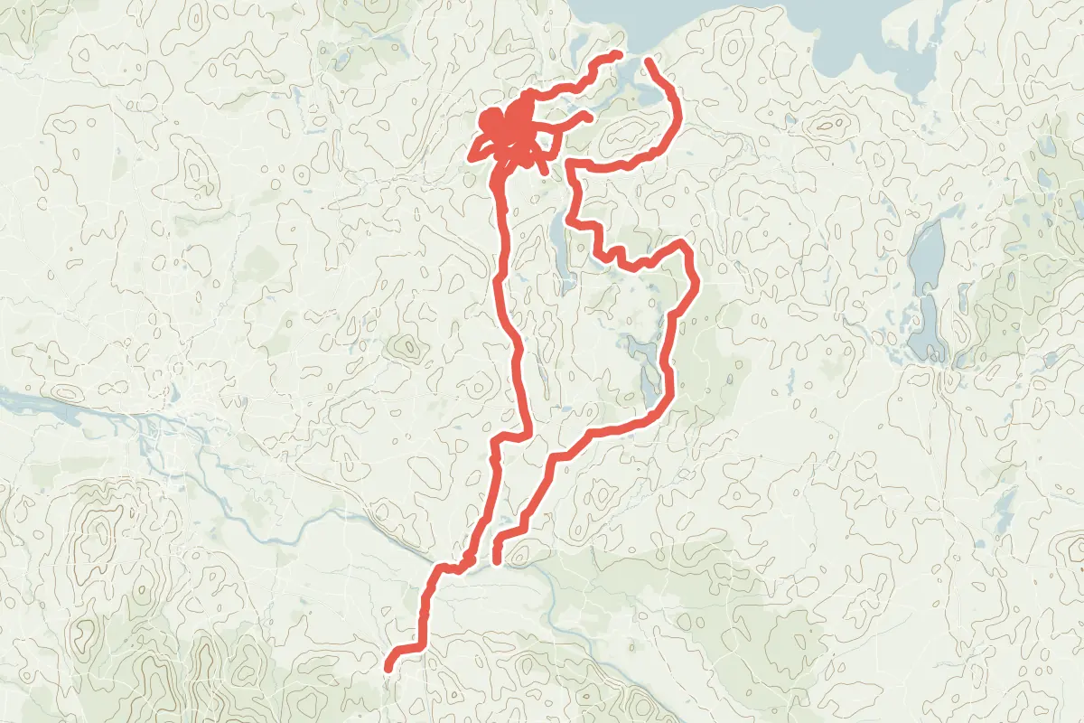
First come a ride Lübeck is known for: Alte Salzstraße, 113.9 km (70.8 mi). The longest ride or track here is R 24: Horst - Pötenitz, 123.1 km (76.5 mi). Radroute Alltag HL Altstadt Süd Holstentor -> Mühlentor runs through the centre itself. Of those of 5 km or more, the hilliest is R 24: Horst - Pötenitz, with about 430 m of climb over 123.1 km (76.5 mi), and the flattest Radnetz HL Z: Moisling - Buniamshof, with about 10 m. 3 long-distance routes pass through as well: EuroVelo 13 - Iron Curtain Trail, EuroVelo 10 - Baltic Sea Cycle Route and Ostseeküsten-Radweg.
How people ride in Germany: a typical ride in Germany was 8.3 km (5.2 mi), at 16.0 km/h (10 mph) while moving, from the rides of 602 Cycle Maps riders in 2014–2022.
How long
- 11 under 5 km (3 mi)
- 8 of 5 to 20 km (3 to 12 mi)
- 3 over 20 km (12 mi)
How hilly
- Flat 11
By each one’s climb per kilometre: flat under 5 m (26 ft a mile), hilly from 15 m (79 ft a mile). Most climbs are estimated.
Popular rides in Lübeck
Chosen by Cycle Maps among the tracks mapped in OpenStreetMap: rides Lübeck is known for.
On the map
Each line is a track; tap one for its name.
Other tracks around Lübeck
- R 24: Horst - Pötenitz Cycling track Flat 123.1 km (76.5 mi) About 430 m (1,410 ft) of climb · 6.4 km (4.0 mi) from the centre
- Radnetz HL-West Cycling track Flat 45.4 km (28.2 mi) About 30 m (100 ft) of climb · 796 m (2,612 ft) from the centre
- HL09 Cycling track Flat 12.4 km (7.7 mi) About 20 m (70 ft) of climb · 678 m (2,224 ft) from the centre
- HL24.1 Cycling track Flat 11.4 km (7.1 mi) About 30 m (100 ft) of climb · 3.0 km (1.9 mi) from the centre
- Radnetz HL 05 Ost Cycling track Flat 8.4 km (5.2 mi) About 20 m (70 ft) of climb · 1.2 km (0.8 mi) from the centre
- Radnetz HL 05 West Cycling track Flat 8.3 km (5.2 mi) About 20 m (70 ft) of climb · 1.3 km (0.8 mi) from the centre
- Radnetz HL 24.2 Cycling track Flat 6.4 km (4.0 mi) About 10 m (30 ft) of climb · 2.9 km (1.8 mi) from the centre
- Radnetz HL 03 Nord Cycling track Flat 6.2 km (3.9 mi) About 20 m (70 ft) of climb · 628 m (2,060 ft) from the centre
- Radnetz HL 03 Süd Cycling track Flat 6.2 km (3.8 mi) About 20 m (70 ft) of climb · 628 m (2,060 ft) from the centre
- Radnetz HL Z: Moisling - Buniamshof Cycling track Flat 5.4 km (3.4 mi) Buniamshof to Moisling · About 10 m (30 ft) of climb · 880 m (2,887 ft) from the centre
- Radnetz HL 11 Ost Cycling track 4.7 km (2.9 mi) About 10 m (30 ft) of climb · 617 m (2,024 ft) from the centre
- Radnetz HL 07 Nord Cycling track 4.6 km (2.8 mi) About 30 m (100 ft) of climb · 867 m (2,844 ft) from the centre
- Radnetz HL 07 Süd Cycling track 4.5 km (2.8 mi) About 20 m (70 ft) of climb · 879 m (2,884 ft) from the centre
- Radnetz HL 08 Süd Cycling track 4.3 km (2.7 mi) Almost flat · 577 m (1,893 ft) from the centre
- Radnetz HL 12 Cycling track 4.0 km (2.5 mi) Buniamshof to Dornbreite · Almost flat · 804 m (2,638 ft) from the centre
- Radnetz HL 08 Nord Cycling track 3.8 km (2.4 mi) Almost flat · 562 m (1,844 ft) from the centre
- Radroute Alltag HL Altstadt Ost Burgtor - Mühlentor Cycling track 2.0 km (1.3 mi) Almost flat · 295 m (968 ft) from the centre
- Radroute Alltag HL Altstadt Ost Mühlentor - Burgtor Cycling track 2.0 km (1.2 mi) Almost flat · 295 m (968 ft) from the centre
- Radroute Alltag HL Altstadt Süd Holstentor -> Mühlentor Cycling track 1.6 km (1.0 mi) About 10 m (30 ft) of climb · through the centre
- Radroute Alltag HL Altstadt Süd Mühlentor - Holstentor Cycling track 1.5 km (0.9 mi) About 10 m (30 ft) of climb · through the centre
- Radroute Alltag HL Altstadt Nord Willy-Brandt-Allee - Burgor Cycling track 1.4 km (0.9 mi) About 20 m (70 ft) of climb · 454 m (1,490 ft) from the centre
Long-distance routes through Lübeck
Lengths and climbs are for the whole route. A route made of other routes that states no length has none here: measured, it would count its variants too.
- EuroVelo 13 - Iron Curtain Trail (EV13) International, cycling 9,950.0 km (6,182.6 mi) · on OpenStreetMap About 4.1 km (2.5 mi) from the centre
- EuroVelo 10 - Baltic Sea Cycle Route (EV10) International, cycling 9,000.0 km (5,592.3 mi) · on OpenStreetMap About 15.6 km (9.7 mi) from the centre
- Ostseeküsten-Radweg (D2) National, cycling · no length stated · its page in German Flensburg to Swinemünde · about 15.5 km (9.6 mi) from the centre
About this list
OpenStreetMap has 103 tracks in or near the square searched around Lübeck; this page shows 1 popular ride, 21 tracks and 3 long-distance routes. One track under 2 km named for a street is left out. The centre is taken as 53.8655° N, 10.6866° E, and the list was made on 1 November 2026. How the city lists are made.
Cities near Lübeck
- Hamburg Germany · 57 km (36 mi) away
- Bremen Germany · 152 km (95 mi) away
- Hanover Germany · 177 km (110 mi) away
- Potsdam Germany · 228 km (142 mi) away
- Berlin Germany · 235 km (146 mi) away
Find tracks anywhere with the app
Cycle Maps is an Android app that finds cycling and mountain-bike tracks near any spot on the map.