 Cycle Maps
Cycling routes in Münster
Cycle Maps lists cycling routes as tracks. 4 rides Münster is known for, then 16 other tracks within 16 km of the centre of Münster, Germany, longest first.
- 20 tracks
- 106.8 km (66.3 mi) the longest
- 843.8 km (524.3 mi) in all

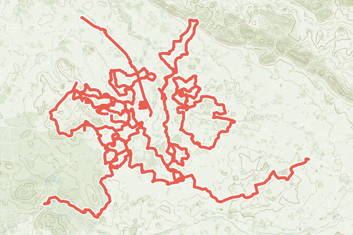
First come rides Münster is known for: Werse Radweg Hauptroute, 106.8 km (66.3 mi) from Rheda-Wiedenbrück to Gelmer; Max-Clemens-Kanal, 39.1 km (24.3 mi); Durch die Baumberge, a loop of 75.6 km (47.0 mi); and Teuto-Permanente, a loop of 72.6 km (45.1 mi). The longest ride or track here is Werse Radweg Hauptroute, 106.8 km (66.3 mi). 14 of them end where they start. The nearest to the centre is Havixbeck Radroute F74, 2.4 km (1.5 mi) from it. Of those of 5 km or more, the hilliest is Durch die Baumberge, with about 450 m of climb over 75.6 km (47.0 mi), and the flattest Biberroute 5, with about 10 m. 5 long-distance routes pass through as well: EuroVelo 3 - La Route des Pèlerins, Europaradweg R1, EuroVelo 2 - Hauptstadt-Route - Teil Deutschland, Europaroute (D-Route 3) and Pilgerroute.
How people ride in Germany: a typical ride in Germany was 8.3 km (5.2 mi), at 16.0 km/h (10 mph) while moving, from the rides of 602 Cycle Maps riders in 2014–2022.
How long
- 2 under 5 km (3 mi)
- 2 of 5 to 20 km (3 to 12 mi)
- 16 over 20 km (12 mi)
How hilly
- Flat 17
- Rolling 1
By each one’s climb per kilometre: flat under 5 m (26 ft a mile), hilly from 15 m (79 ft a mile). Most climbs are estimated.
Popular rides in Münster
Chosen by Cycle Maps among the tracks mapped in OpenStreetMap: rides Münster is known for.
- Werse Radweg Hauptroute Cycling track Flat 106.8 km (66.3 mi) Rheda-Wiedenbrück to Gelmer · About 320 m (1,050 ft) of climb · 4.4 km (2.8 mi) from the centre
- Max-Clemens-Kanal Cycling track Flat 39.1 km (24.3 mi) About 50 m (160 ft) of climb · 671 m (2,201 ft) from the centre
- Durch die Baumberge Cycling track Rolling 75.6 km (47.0 mi) Loop · About 450 m (1,480 ft) of climb · 5.6 km (3.5 mi) from the centre
- Teuto-Permanente Cycling track Flat 72.6 km (45.1 mi) Loop · About 160 m (520 ft) of climb · 6.6 km (4.1 mi) from the centre
On the map
Each line is a track; tap one for its name.
Other tracks around Münster
- Stever Land Route Cycling track Flat 71.4 km (44.4 mi) Nottuln to Haltern am See · About 220 m (720 ft) of climb · 13.7 km (8.5 mi) from the centre
- R1 RTF Cycling track Flat 71.3 km (44.3 mi) Loop · About 250 m (820 ft) of climb · 3.4 km (2.1 mi) from the centre
- Freckyo Permanente Cycling track Flat 71.0 km (44.1 mi) Loop · About 160 m (520 ft) of climb · 8.4 km (5.2 mi) from the centre
- NaTourismus Schlehenroute Cycling track Flat 44.6 km (27.7 mi) Loop · About 140 m (460 ft) of climb · 9.5 km (5.9 mi) from the centre
- Havixbeck Radroute F75 Cycling track Flat 40.7 km (25.3 mi) About 160 m (520 ft) of climb · 10.9 km (6.7 mi) from the centre
- Havixbeck Radroute F74 Cycling track Flat 37.3 km (23.1 mi) Loop · About 170 m (560 ft) of climb · 2.4 km (1.5 mi) from the centre
- F27 Cycling track Flat 36.9 km (22.9 mi) Loop · About 130 m (430 ft) of climb · 9.8 km (6.1 mi) from the centre
- F2 Cycling track Flat 32.5 km (20.2 mi) Loop · About 140 m (460 ft) of climb · 9.8 km (6.1 mi) from the centre
- R2 RTF Cycling track Flat 32.1 km (19.9 mi) Loop · About 110 m (360 ft) of climb · 6.2 km (3.9 mi) from the centre
- Biberroute 5 Cycling track Flat 27.6 km (17.1 mi) Loop · About 10 m (30 ft) of climb · 11.0 km (6.8 mi) from the centre
- Grüner Kranz Cycling track Flat 23.7 km (14.8 mi) Loop · About 70 m (230 ft) of climb · 9.6 km (6.0 mi) from the centre
- Westbeverner Kulturroute Cycling track Flat 20.8 km (12.9 mi) Loop · About 90 m (300 ft) of climb · 8.8 km (5.5 mi) from the centre
- Biberroute 4 Cycling track Flat 18.0 km (11.2 mi) Loop · About 40 m (130 ft) of climb · 11.0 km (6.8 mi) from the centre
- Kinderhauser Rundweg Rot Cycling track Flat 12.1 km (7.5 mi) Loop · About 40 m (130 ft) of climb · 3.0 km (1.9 mi) from the centre
- Kinderhauser Rundweg Blau Cycling track 4.9 km (3.1 mi) Loop · About 20 m (70 ft) of climb · 3.9 km (2.4 mi) from the centre
- Kinderhauser Rundweg Grün Cycling track 4.8 km (3.0 mi) Loop · Almost flat · 3.2 km (2.0 mi) from the centre
Long-distance routes through Münster
Lengths and climbs are for the whole route. A route made of other routes that states no length has none here: measured, it would count its variants too.
- EuroVelo 3 - La Route des Pèlerins (EV3) International, cycling · no length stated · on OpenStreetMap About 664 m (2,178 ft) from the centre
- Europaradweg R1 International, cycling 5,117.0 km (3,179.6 mi) · on OpenStreetMap London to Moscow · about 666 m (2,185 ft) from the centre
- EuroVelo 2 - Hauptstadt-Route - Teil Deutschland (EV2) International, cycling 960.0 km (596.5 mi) · on OpenStreetMap Zwillbrock DE/NL to Küstrin-Kietz DE/PL · about 611 m (2,005 ft) from the centre
- Europaroute (D-Route 3) (D3) National, cycling 960.0 km (596.5 mi) · on OpenStreetMap Niederländische Grenze bei Zwillbrock to Polnische Grenze bei Küstrin-Kietz · about 610 m (2,001 ft) from the centre
- Pilgerroute (D7) National, cycling 1,065.0 km (661.8 mi) · on OpenStreetMap Aachen to Flensburg · about 629 m (2,064 ft) from the centre
About this list
OpenStreetMap has 114 tracks in or near the square searched around Münster; this page shows 4 popular rides, 16 tracks and 5 long-distance routes. The centre is taken as 51.9625° N, 7.6256° E, and the list was made on 1 November 2026. How the city lists are made.
Cities near Münster
- Düsseldorf Germany · 101 km (63 mi) away
- Cologne Germany · 123 km (76 mi) away
- Bremen Germany · 147 km (92 mi) away
- Hanover Germany · 151 km (94 mi) away
- Frankfurt Germany · 219 km (136 mi) away
Find tracks anywhere with the app
Cycle Maps is an Android app that finds cycling and mountain-bike tracks near any spot on the map.