 Cycle Maps
Cycling routes in Leipzig
Cycle Maps lists cycling routes as tracks. 3 rides Leipzig is known for, then 10 other tracks within 16 km of the centre of Leipzig, Germany, longest first.
- 13 tracks
- 136.8 km (85.0 mi) the longest
- 664.0 km (412.6 mi) in all

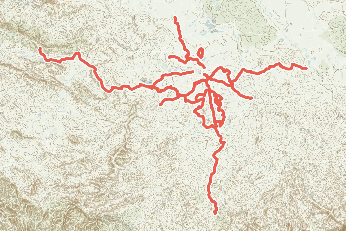
First come rides Leipzig is known for: Neuseenland-Radroute, a loop of 101.7 km (63.2 mi); Leipzig–Elbe-Radroute, 79.4 km (49.3 mi) from Leipzig to Schirmenitz; and Parthe–Mulde-Radroute, 53.0 km (33.0 mi) from Leipzig to Grimma. The longest ride or track here is Salzstraße-Radroute, 136.8 km (85.0 mi). 2 of them end where they start. The nearest to the centre is Radroute Zentrum - Kulkwitzer See, 360 m (1,181 ft) from it. Of those of 5 km or more, the hilliest is Salzstraße-Radroute, with about 830 m of climb over 136.8 km (85.0 mi), and the flattest Leipzig-Weißenfels Teilstück, with about 10 m. 2 long-distance routes pass through as well: Grüner Ring Leipzig and Kohle-Dampf-Licht-Seen-Radroute.
How people ride in Germany: a typical ride in Germany was 8.3 km (5.2 mi), at 16.0 km/h (10 mph) while moving, from the rides of 602 Cycle Maps riders in 2014–2022.
How long
- 3 of 5 to 20 km (3 to 12 mi)
- 10 over 20 km (12 mi)
How hilly
- Flat 12
- Rolling 1
By each one’s climb per kilometre: flat under 5 m (26 ft a mile), hilly from 15 m (79 ft a mile). Most climbs are estimated.
Popular rides in Leipzig
Chosen by Cycle Maps among the tracks mapped in OpenStreetMap: rides Leipzig is known for.
- Neuseenland-Radroute Cycling track Flat 101.7 km (63.2 mi) Loop · About 230 m (750 ft) of climb · 6.6 km (4.1 mi) from the centre
- Leipzig–Elbe-Radroute Cycling track Flat 79.4 km (49.3 mi) Leipzig to Schirmenitz · About 350 m (1,150 ft) of climb · 492 m (1,614 ft) from the centre
- Parthe–Mulde-Radroute Cycling track Flat 53.0 km (33.0 mi) Leipzig to Grimma · About 150 m (490 ft) of climb · 535 m (1,755 ft) from the centre
On the map
Each line is a track; tap one for its name.
Other tracks around Leipzig
- Salzstraße-Radroute Cycling track Rolling 136.8 km (85.0 mi) About 830 m (2,720 ft) of climb · 9.8 km (6.1 mi) from the centre
- Pleiße-Radroute Cycling track Flat 105.3 km (65.5 mi) About 480 m (1,570 ft) of climb · 1.6 km (1.0 mi) from the centre
- Sole-Kohle-Geschichte Radroute Cycling track Flat 43.9 km (27.3 mi) About 140 m (460 ft) of climb · 14.9 km (9.2 mi) from the centre
- Strengbach Radweg Cycling track Flat 36.3 km (22.5 mi) Glesien to Radegast · About 50 m (160 ft) of climb · 15.4 km (9.6 mi) from the centre
- Salzfuhrweg Halle–Leipzig Cycling track Flat 28.3 km (17.6 mi) Halle Saale to Leipzig · About 60 m (200 ft) of climb · 6.7 km (4.2 mi) from the centre
- Elster–Saale-Radroute Cycling track Flat 26.1 km (16.2 mi) Leipzig Stadtgrenze to Weißenfels Bahnhof · About 60 m (200 ft) of climb · 8.9 km (5.5 mi) from the centre
- Störmthaler See Radweg Cycling track Flat 23.8 km (14.8 mi) Loop · About 80 m (260 ft) of climb · 10.2 km (6.3 mi) from the centre
- Radroute Rundweg Werbeliner See Cycling track Flat 13.5 km (8.4 mi) Loop · About 20 m (70 ft) of climb · 12.8 km (8.0 mi) from the centre
- Radroute Zentrum - Kulkwitzer See Cycling track Flat 9.6 km (6.0 mi) About 20 m (70 ft) of climb · 360 m (1,181 ft) from the centre
- Leipzig-Weißenfels Teilstück Cycling track Flat 6.2 km (3.8 mi) Leipzig Stadtgrenze to Leipzig Karl-Heine-Kanal · About 10 m (30 ft) of climb · 5.2 km (3.2 mi) from the centre
Long-distance routes through Leipzig
Lengths and climbs are for the whole route.
- Grüner Ring Leipzig (GRL) Regional, cycling 144.2 km (89.6 mi) · on OpenStreetMap Loop · about 8.4 km (5.2 mi) from the centre
- Kohle-Dampf-Licht-Seen-Radroute (KDLS) Regional, cycling 160.0 km (99.4 mi) · on OpenStreetMap Großstolpen (bei Groitzsch) to Lutherstadt Wittenberg · about 1.1 km (0.7 mi) from the centre
About this list
OpenStreetMap has 23 tracks in or near the square searched around Leipzig; this page shows 3 popular rides, 10 tracks and 2 long-distance routes. The centre is taken as 51.3397° N, 12.3731° E, and the list was made on 1 November 2026. How the city lists are made.
Cities near Leipzig
- Dresden Germany · 100 km (62 mi) away
- Erfurt Germany · 102 km (63 mi) away
- Potsdam Germany · 126 km (78 mi) away
- Berlin Germany · 149 km (93 mi) away
- Hanover Germany · 214 km (133 mi) away
Find tracks anywhere with the app
Cycle Maps is an Android app that finds cycling and mountain-bike tracks near any spot on the map.