 Cycle Maps
Cycling routes and mountain-bike trails in Freiburg
Cycle Maps lists cycling routes and mountain-bike trails as tracks. 3 rides Freiburg is known for, then 19 other tracks within 16 km of the centre of Freiburg, Germany, longest first.
- 22 tracks
- 77.8 km (48.3 mi) the longest
- 465.8 km (289.4 mi) in all

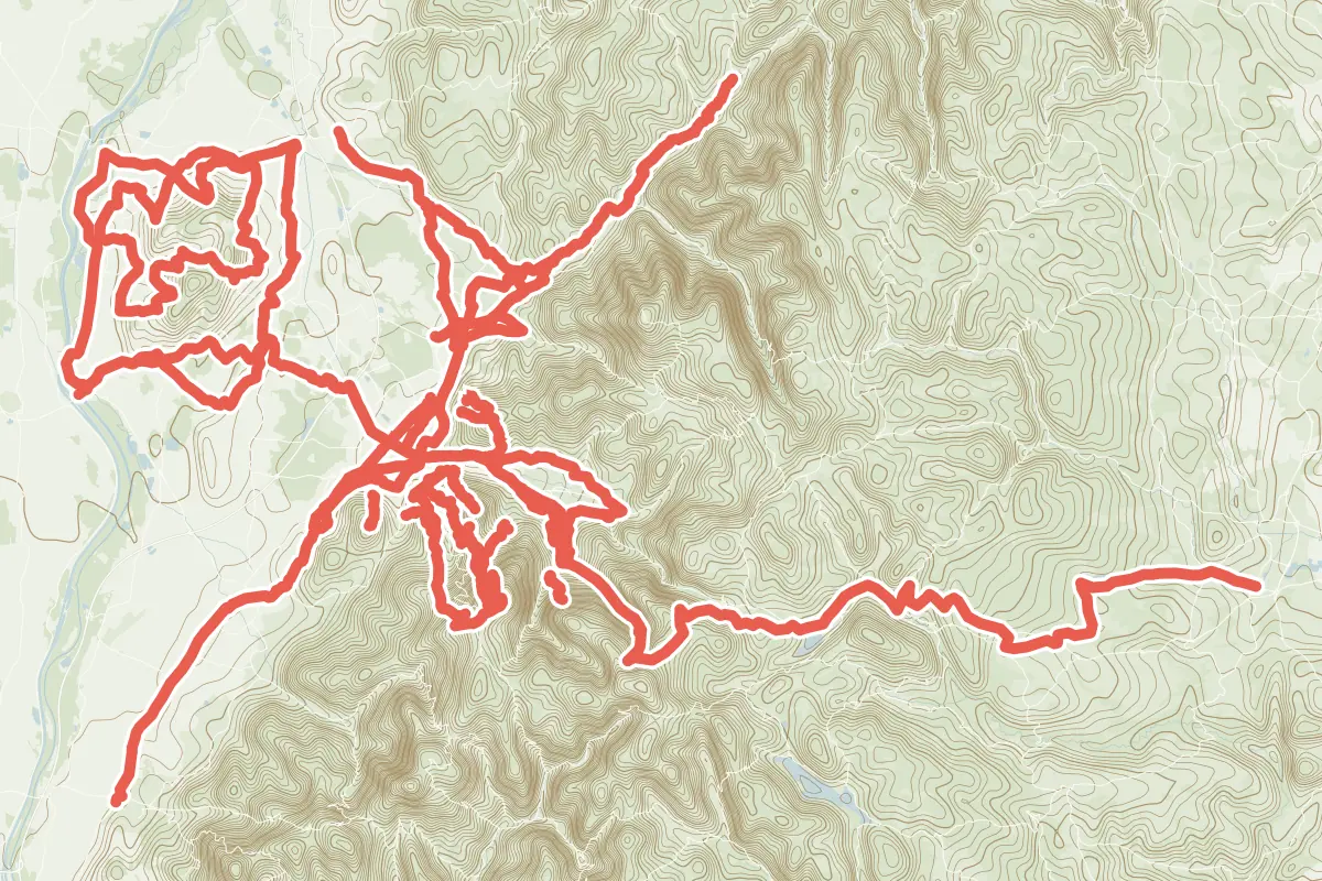
First come rides Freiburg is known for: Dreisamtal-Radwanderweg, 32.2 km (20.0 mi); Kaiserstuhl-Radwanderweg, a loop of 61.2 km (38.1 mi); and Badischer Weinradweg - Etappe 2 Variante: Freiburg/Glottertal, 43.4 km (27.0 mi) from Schallstadt to Riegel. Of the 19 other tracks around the centre, 10 are for mountain bikes and 9 for cycling. The longest ride or track here is RadNETZ Freiburg - Hüfingen, 77.8 km (48.3 mi). Kaiser-Tour ends where it starts. The nearest to the centre is RadNETZ Freiburg - Hüfingen, 588 m (1,929 ft) from it. Of those of 5 km or more, the hilliest is Kaiser-Tour, with 1,500 m of climb over 59.3 km (36.8 mi), and the flattest Radweg FR2, with about 10 m. One long-distance route passes through as well: Breisgau-Radwanderweg.
How people ride in Germany: a typical ride in Germany was 8.3 km (5.2 mi), at 16.0 km/h (10 mph) while moving, from the rides of 602 Cycle Maps riders in 2014–2022.
How long
- 8 under 5 km (3 mi)
- 5 of 5 to 20 km (3 to 12 mi)
- 9 over 20 km (12 mi)
How hilly
- Flat 5
- Rolling 5
- Hilly 4
By each one’s climb per kilometre: flat under 5 m (26 ft a mile), hilly from 15 m (79 ft a mile). Most climbs are estimated.
Popular rides in Freiburg
Chosen by Cycle Maps among the tracks mapped in OpenStreetMap: rides Freiburg is known for.
- Dreisamtal-Radwanderweg Cycling track Rolling 32.2 km (20.0 mi) About 340 m (1,120 ft) of climb · 474 m (1,555 ft) from the centre
- Kaiserstuhl-Radwanderweg Cycling track Flat 61.2 km (38.1 mi) Loop · About 220 m (720 ft) of climb · 10.7 km (6.7 mi) from the centre
- Badischer Weinradweg - Etappe 2 Variante: Freiburg/Glottertal Cycling track Flat 43.4 km (27.0 mi) Schallstadt to Riegel · 163 m (535 ft) of climb · 242 m (794 ft) from the centre
On the map
Each line is a track; tap one for its name.
Other tracks around Freiburg
- RadNETZ Freiburg - Hüfingen Cycling track Hilly 77.8 km (48.3 mi) About 1,450 m (4,760 ft) of climb · 588 m (1,929 ft) from the centre
- Kaiser-Tour Mountain-bike track Hilly 59.3 km (36.8 mi) Loop · 1,500 m (4,921 ft) of climb · 14.1 km (8.7 mi) from the centre
- MTB Trans-Schauinsland Mountain-bike track Hilly 36.3 km (22.6 mi) 1,000 m (3,281 ft) of climb · 1.5 km (1.0 mi) from the centre
- RadNETZ Müllheim - Freiburg Cycling track Flat 31.5 km (19.6 mi) About 80 m (260 ft) of climb · 843 m (2,766 ft) from the centre
- Elztal-Radweg Cycling track Rolling 28.4 km (17.7 mi) About 350 m (1,150 ft) of climb · 6.2 km (3.9 mi) from the centre
- RadNETZ Breisach am Rhein - Freiburg Cycling track Rolling 28.1 km (17.5 mi) About 190 m (620 ft) of climb · 824 m (2,703 ft) from the centre
- Radweg FR1 Cycling track Rolling 14.0 km (8.7 mi) About 160 m (520 ft) of climb · 588 m (1,929 ft) from the centre
- RadNETZ Gundelfingen - Emmendingen Cycling track Flat 9.5 km (5.9 mi) About 30 m (100 ft) of climb · 5.8 km (3.6 mi) from the centre
- RadNETZ Gundelfingen - Waldkirch Cycling track Rolling 8.8 km (5.5 mi) About 60 m (200 ft) of climb · 5.9 km (3.6 mi) from the centre
- Badish Moon Rising Mountain-bike track Hilly 6.5 km (4.0 mi) About 620 m (2,030 ft) of climb · 5.2 km (3.2 mi) from the centre
- Radweg FR2 Cycling track Flat 6.2 km (3.8 mi) About 10 m (30 ft) of climb · 1.8 km (1.1 mi) from the centre
- Canadian Trail Mountain-bike track 3.8 km (2.4 mi) About 500 m (1,640 ft) of climb · 1.7 km (1.1 mi) from the centre
- Borderline Mountain-bike track 3.4 km (2.1 mi) About 420 m (1,380 ft) of climb · 3.2 km (2.0 mi) from the centre
- Baden to the Bone Mountain-bike track 3.3 km (2.0 mi) About 380 m (1,250 ft) of climb · 3.3 km (2.1 mi) from the centre
- Radweg FR3 Cycling track 2.9 km (1.8 mi) Almost flat · 1.2 km (0.7 mi) from the centre
- Hexentrail Mountain-bike track 2.8 km (1.7 mi) 60 m (197 ft) of climb · 3.8 km (2.4 mi) from the centre
- Schöni Trail Mountain-bike track 2.3 km (1.4 mi) About 310 m (1,020 ft) of climb · 4.3 km (2.7 mi) from the centre
- Schädelwäg Mountain-bike track 2.2 km (1.3 mi) 10.2 km (6.3 mi) from the centre
- Hubbelfuchs Mountain-bike track 2.1 km (1.3 mi) Rosskopf to Fuchsköpfleweg · 30 m (98 ft) of climb · 2.6 km (1.6 mi) from the centre
Long-distance routes through Freiburg
Lengths and climbs are for the whole route.
About this list
OpenStreetMap has 67 tracks in or near the square searched around Freiburg; this page shows 3 popular rides, 19 tracks and 1 long-distance route. 2 tracks shorter than 1 km are left out. The centre is taken as 47.9959° N, 7.8522° E, and the list was made on 1 November 2026. How the city lists are made.
Cities near Freiburg
- Zurich Switzerland · 86 km (53 mi) away
- Lucerne Switzerland · 111 km (69 mi) away
- Karlsruhe Germany · 120 km (74 mi) away
- Stuttgart Germany · 131 km (81 mi) away
- Heidelberg Germany · 169 km (105 mi) away
Find tracks anywhere with the app
Cycle Maps is an Android app that finds cycling and mountain-bike tracks near any spot on the map.