 Cycle Maps
Cycling routes and mountain-bike trails in Heidelberg
Cycle Maps lists cycling routes and mountain-bike trails as tracks. 2 rides Heidelberg is known for, then 20 other tracks within 16 km of the centre of Heidelberg, Germany, longest first.
- 22 tracks
- 88.7 km (55.1 mi) the longest
- 675.5 km (419.7 mi) in all

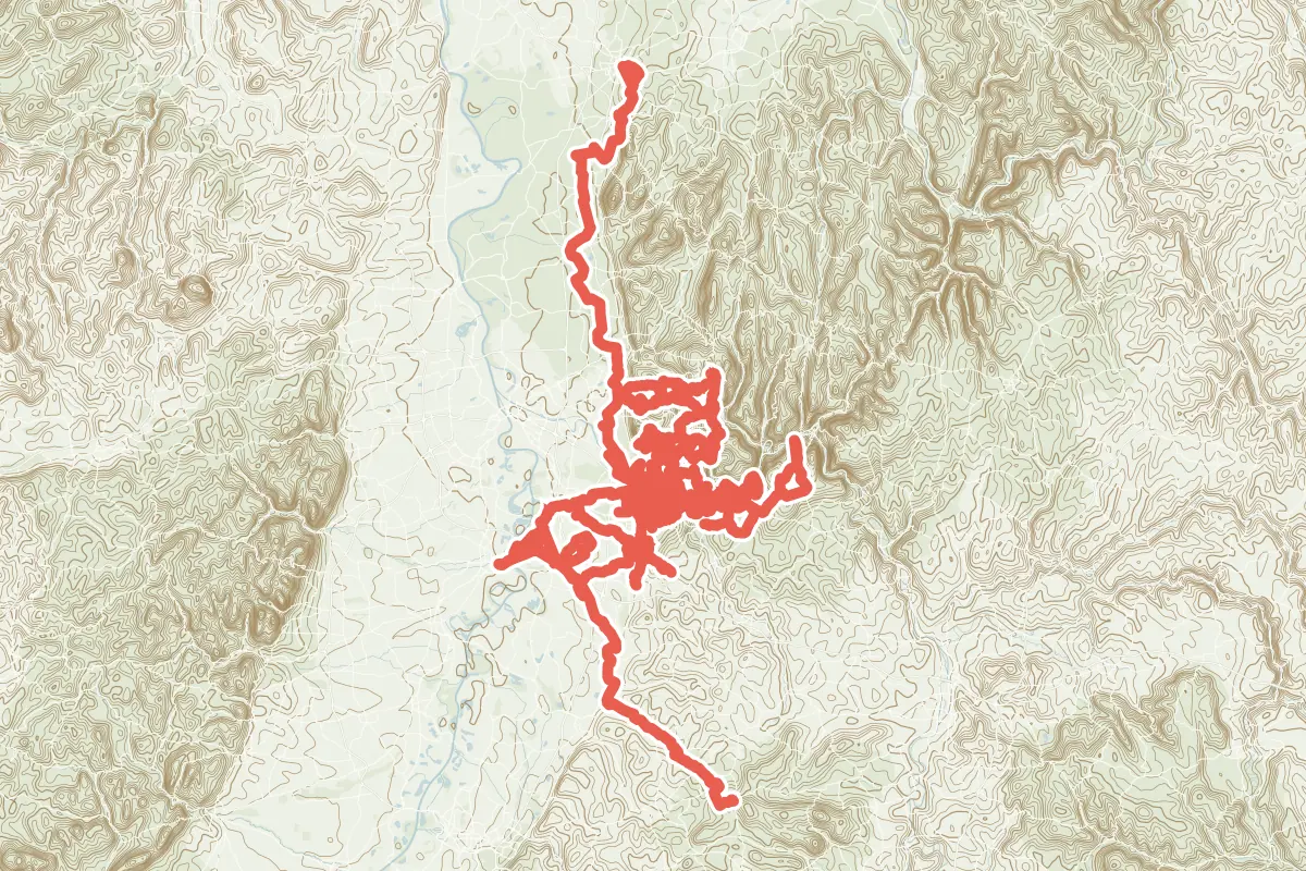
First come rides Heidelberg is known for: Die Bergstraße naturnah, 85.4 km (53.1 mi) from Darmstadt to Heidelberg; and Kurpfalzroute Radweg von Heidelberg nach Speyer, 29.4 km (18.3 mi) from Heidelberg to Speyer. Of the 20 other tracks around the centre, 10 are for cycling and 10 for mountain bikes. The longest ride or track here is Radverkehrsnetz Stadt Heidelberg, 88.7 km (55.1 mi). 12 of them end where they start. Radverkehrsnetz Stadt Heidelberg runs through the centre itself. Of those of 5 km or more, the hilliest is Neckargemünd 1, with 1,720 m of climb over 55.3 km (34.4 mi), and the flattest RadNETZ Wiesloch - Heidelberg, with about 30 m. 4 long-distance routes pass through as well: Paneuropa Route, EuroVelo 15 - Rheinradweg, D8 Rhein-Route and Odenwald-Madonnen-Weg.
How people ride in Germany: a typical ride in Germany was 8.3 km (5.2 mi), at 16.0 km/h (10 mph) while moving, from the rides of 602 Cycle Maps riders in 2014–2022.
How long
- 4 under 5 km (3 mi)
- 4 of 5 to 20 km (3 to 12 mi)
- 14 over 20 km (12 mi)
How hilly
- Flat 7
- Rolling 1
- Hilly 10
By each one’s climb per kilometre: flat under 5 m (26 ft a mile), hilly from 15 m (79 ft a mile). Most climbs are estimated.
Popular rides in Heidelberg
Chosen by Cycle Maps among the tracks mapped in OpenStreetMap: rides Heidelberg is known for.
- Die Bergstraße naturnah Cycling track Flat 85.4 km (53.1 mi) Darmstadt to Heidelberg · About 260 m (850 ft) of climb · 447 m (1,467 ft) from the centre
- Kurpfalzroute Radweg von Heidelberg nach Speyer Cycling track Flat 29.4 km (18.3 mi) Heidelberg to Speyer · About 30 m (100 ft) of climb · through the centre
On the map
Each line is a track; tap one for its name.
Other tracks around Heidelberg
- Radverkehrsnetz Stadt Heidelberg Cycling track Rolling 88.7 km (55.1 mi) About 1,310 m (4,300 ft) of climb · through the centre
- Kraich-Radweg Cycling track Flat 62.4 km (38.8 mi) 101 m (331 ft) of climb · 14.0 km (8.7 mi) from the centre
- Neckargemünd 1 Mountain-bike track Hilly 55.3 km (34.4 mi) Loop · 1,720 m (5,643 ft) of climb · 554 m (1,818 ft) from the centre
- Lokales Radwegenetz Rhein-Neckar-Kreis Ost Cycling track Hilly 44.0 km (27.4 mi) About 830 m (2,720 ft) of climb · 9.2 km (5.7 mi) from the centre
- Weitersehen - Ur-Rhein-Tour Cycling track Flat 39.5 km (24.5 mi) Loop · About 70 m (230 ft) of climb · 7.3 km (4.5 mi) from the centre
- Heidelberg 1 Mountain-bike track Hilly 34.7 km (21.5 mi) Loop · 1,075 m (3,527 ft) of climb · 1.1 km (0.7 mi) from the centre
- Kurpfalzroute Radweg von Speyer nach Heidelberg Cycling track Flat 30.2 km (18.8 mi) Speyer to Heidelberg · About 30 m (100 ft) of climb · through the centre
- Heiligkreuzsteinach 1 Mountain-bike track Hilly 29.2 km (18.2 mi) Loop · 770 m (2,526 ft) of climb · 10.3 km (6.4 mi) from the centre
- Neckargemünd 2 Mountain-bike track Hilly 29.1 km (18.1 mi) Loop · 650 m (2,133 ft) of climb · 7.5 km (4.7 mi) from the centre
- Schönau 1 Mountain-bike track Hilly 27.6 km (17.2 mi) Loop · 795 m (2,608 ft) of climb · 2.7 km (1.7 mi) from the centre
- Wilhelmsfeld 1 Mountain-bike track Hilly 25.3 km (15.7 mi) Loop · 765 m (2,510 ft) of climb · 6.3 km (3.9 mi) from the centre
- Gaiberg 1 Mountain-bike track Hilly 23.8 km (14.8 mi) Loop · 530 m (1,739 ft) of climb · 2.5 km (1.5 mi) from the centre
- Hirschberg 1 Mountain-bike track Hilly 19.0 km (11.8 mi) Loop · 630 m (2,067 ft) of climb · 8.7 km (5.4 mi) from the centre
- Steinbrecher Trails Mountain-bike track Hilly 18.1 km (11.2 mi) Loop · 800 m (2,625 ft) of climb · 3.9 km (2.4 mi) from the centre
- Sparkassen-Route 2 Cycling track Flat 10.7 km (6.7 mi) Loop · About 30 m (100 ft) of climb · 10.1 km (6.3 mi) from the centre
- RadNETZ Wiesloch - Heidelberg Cycling track Flat 8.7 km (5.4 mi) About 30 m (100 ft) of climb · 5.7 km (3.5 mi) from the centre
- Nußloch - Baiertal Cycling track 4.4 km (2.7 mi) About 80 m (260 ft) of climb · 9.7 km (6.0 mi) from the centre
- Campus-Rundweg Cycling track 4.0 km (2.5 mi) About 20 m (70 ft) of climb · through the centre
- Mountainbike-Trainingsstrecke des HD-Freeride e.V. Mountain-bike track 3.1 km (1.9 mi) Loop · About 250 m (820 ft) of climb · 1.7 km (1.0 mi) from the centre
- Nußloch - Leimen Cycling track 2.8 km (1.8 mi) About 40 m (130 ft) of climb · 7.5 km (4.7 mi) from the centre
Long-distance routes through Heidelberg
Lengths and climbs are for the whole route. A route made of other routes that states no length has none here: measured, it would count its variants too.
- Paneuropa Route (PAN) International, cycling · no length stated · on OpenStreetMap Paris to Prague · about 186 m (610 ft) from the centre
- EuroVelo 15 - Rheinradweg (EV15) International, cycling 1,230.0 km (764.3 mi) · on OpenStreetMap About 11.5 km (7.2 mi) from the centre
- D8 Rhein-Route National, cycling 1,019.0 km (633.2 mi) · on OpenStreetMap About 13.9 km (8.7 mi) from the centre
- Odenwald-Madonnen-Weg (OMW) Regional, cycling 179.0 km (111.2 mi) · on OpenStreetMap Tauberbischofsheim to Speyer · 580 m (1,903 ft) of climb · through the centre
About this list
OpenStreetMap has 86 tracks in or near the square searched around Heidelberg; this page shows 2 popular rides, 20 tracks and 4 long-distance routes. One track shorter than 1 km is left out. The centre is taken as 49.4094° N, 8.6947° E, and the list was made on 1 November 2026. How the city lists are made.
Cities near Heidelberg
- Karlsruhe Germany · 49 km (31 mi) away
- Mainz Germany · 72 km (45 mi) away
- Frankfurt Germany · 78 km (48 mi) away
- Stuttgart Germany · 79 km (49 mi) away
- Trier Germany · 153 km (95 mi) away
Find tracks anywhere with the app
Cycle Maps is an Android app that finds cycling and mountain-bike tracks near any spot on the map.