 Cycle Maps
Cycling routes and mountain-bike trails in Lucerne
Cycle Maps lists cycling routes and mountain-bike trails as tracks. 3 rides Lucerne is known for, then 19 other tracks within 16 km of the centre of Lucerne, Switzerland, longest first.
- 22 tracks
- 113.5 km (70.6 mi) the longest
- 569.3 km (353.8 mi) in all

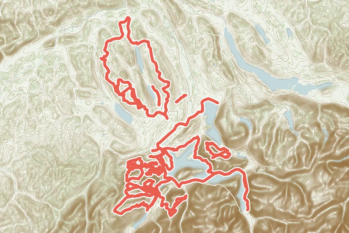
First come rides Lucerne is known for: Seen-Route, 60.3 km (37.5 mi) from Sarnen to Zug; Nord-Süd-Route, 55.0 km (34.2 mi) from Luzern to Flüelen; and Luzerner Hinterland-Rigi, 39.4 km (24.5 mi) from Luzern to Brunnen. Of the 19 other tracks around the centre, 10 are for mountain bikes and 9 for cycling. The longest ride or track here is Herzschlaufe - Seetal, 113.5 km (70.6 mi). 8 of them end where they start. The nearest to the centre is Luzern - Littau, 100 m (328 ft) from it. Of those of 5 km or more, the hilliest is Herzschlaufe - Seetal, with about 2,020 m of climb over 113.5 km (70.6 mi), and the flattest Hochdorf - Kleinwangen - Gelfingen, with about 60 m. 3 long-distance routes pass through as well: EuroVelo 5 - Via Romea Francigena, Alpenpanorama-Route and Panorama Bike.
How long
- 6 under 5 km (3 mi)
- 4 of 5 to 20 km (3 to 12 mi)
- 12 over 20 km (12 mi)
How hilly
- Rolling 3
- Hilly 13
By each one’s climb per kilometre: flat under 5 m (26 ft a mile), hilly from 15 m (79 ft a mile). Most climbs are estimated.
Popular rides in Lucerne
Chosen by Cycle Maps among the tracks mapped in OpenStreetMap: rides Lucerne is known for.
- Seen-Route Cycling track Rolling 60.3 km (37.5 mi) Sarnen to Zug · About 380 m (1,250 ft) of climb · through the centre
- Nord-Süd-Route Cycling track Hilly 55.0 km (34.2 mi) Luzern to Flüelen · About 1,030 m (3,380 ft) of climb · through the centre
- Luzerner Hinterland-Rigi Cycling track Hilly 39.4 km (24.5 mi) Luzern to Brunnen · About 820 m (2,690 ft) of climb · through the centre
On the map
Each line is a track; tap one for its name.
Other tracks around Lucerne
- Herzschlaufe - Seetal Cycling track Hilly 113.5 km (70.6 mi) Loop · About 2,020 m (6,630 ft) of climb · 9.1 km (5.7 mi) from the centre
- o-tour Bike West Mountain-bike track Hilly 48.8 km (30.3 mi) About 1,810 m (5,940 ft) of climb · 10.8 km (6.7 mi) from the centre
- Pilatus Mountain-bike track Hilly 39.8 km (24.8 mi) About 1,730 m (5,680 ft) of climb · 4.1 km (2.6 mi) from the centre
- Alpnach - Schrotenegg - Chretzenalp - Alpnach Mountain-bike track Hilly 30.9 km (19.2 mi) About 1,700 m (5,580 ft) of climb · 10.6 km (6.6 mi) from the centre
- Runde Michelsamt Cycling track Rolling 29.5 km (18.3 mi) Loop · About 410 m (1,350 ft) of climb · 14.0 km (8.7 mi) from the centre
- Dallenwil - Wirzweli - Arvigrat - St. Jakob - Alpnach Mountain-bike track Hilly 28.5 km (17.7 mi) About 1,700 m (5,580 ft) of climb · 12.1 km (7.5 mi) from the centre
- Rigi Bike Tour Mountain-bike track Hilly 24.8 km (15.4 mi) Loop · 1,729 m (5,673 ft) of climb · 12.1 km (7.5 mi) from the centre
- Alpnach - Lütoldsmatt - Chilchsteine - Chretzenalp - Alpnach Mountain-bike track Hilly 21.3 km (13.2 mi) Loop · About 1,580 m (5,180 ft) of climb · 9.4 km (5.8 mi) from the centre
- Stäfeli Mountain-bike track Hilly 20.1 km (12.5 mi) Loop · 784 m (2,572 ft) of climb · 8.4 km (5.2 mi) from the centre
- Chräigütsch Mountain-bike track Hilly 13.4 km (8.3 mi) Loop · 425 m (1,394 ft) of climb · 7.2 km (4.4 mi) from the centre
- Guberwald und Bawald Mountain-bike track Hilly 9.3 km (5.8 mi) Loop · 316 m (1,037 ft) of climb · 8.3 km (5.2 mi) from the centre
- Öber d´Bäch Mountain-bike track Hilly 7.2 km (4.5 mi) Loop · 257 m (843 ft) of climb · 9.8 km (6.1 mi) from the centre
- Hochdorf - Kleinwangen - Gelfingen Cycling track Rolling 6.2 km (3.8 mi) About 60 m (200 ft) of climb · 13.0 km (8.1 mi) from the centre
- Horw Bahnhof- Luzern Cycling track 4.2 km (2.6 mi) About 20 m (70 ft) of climb · 439 m (1,440 ft) from the centre
- Luzern - Littau Cycling track 4.1 km (2.5 mi) About 80 m (260 ft) of climb · 100 m (328 ft) from the centre
- Horw - Kriens Cycling track 3.7 km (2.3 mi) About 50 m (160 ft) of climb · 2.8 km (1.8 mi) from the centre
- Sins-Hochdorf Cycling track 3.6 km (2.3 mi) About 110 m (360 ft) of climb · 14.2 km (8.9 mi) from the centre
- Luzern - Kriens Cycling track 3.6 km (2.2 mi) About 50 m (160 ft) of climb · 100 m (328 ft) from the centre
- Kriens - Obernau Cycling track 1.9 km (1.2 mi) About 50 m (160 ft) of climb · 2.9 km (1.8 mi) from the centre
Long-distance routes through Lucerne
Lengths and climbs are for the whole route. A route made of other routes that states no length has none here: measured, it would count its variants too.
- EuroVelo 5 - Via Romea Francigena (EV5) International, cycling 3,900.0 km (2,423.3 mi) · on OpenStreetMap Canterbury, Canterbury Cathedral to Brindisi · about 105 m (344 ft) from the centre
- Alpenpanorama-Route (4) National, cycling 475.0 km (295.2 mi) · on OpenStreetMap St. Margrethen to Aigle · about 8.0 km (5.0 mi) from the centre
- Panorama Bike (2) National, mountain-bike · no length stated · on OpenStreetMap Rorschach to Montreux · about 10.5 km (6.5 mi) from the centre
About this list
OpenStreetMap has 59 tracks in or near the square searched around Lucerne; this page shows 3 popular rides, 19 tracks and 3 long-distance routes. 2 tracks shorter than 1 km are left out. The centre is taken as 47.0502° N, 8.3093° E, and the list was made on 1 November 2026. How the city lists are made.
Cities near Lucerne
- Zurich Switzerland · 40 km (25 mi) away
- Bern Switzerland · 66 km (41 mi) away
- Freiburg Germany · 111 km (69 mi) away
Find tracks anywhere with the app
Cycle Maps is an Android app that finds cycling and mountain-bike tracks near any spot on the map.