 Cycle Maps
Cycling routes and mountain-bike trails in Stuttgart
Cycle Maps lists cycling routes and mountain-bike trails as tracks. 4 rides Stuttgart is known for, then 19 other tracks within 16 km of the centre of Stuttgart, Germany, longest first.
- 23 tracks
- 80.3 km (49.9 mi) the longest
- 598.1 km (371.7 mi) in all

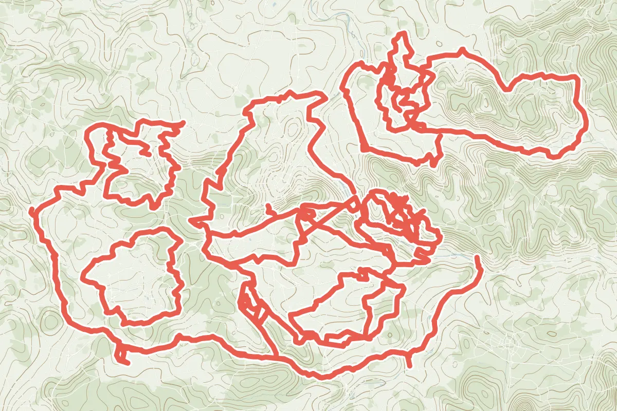
First come rides Stuttgart is known for: Radelthon Stuttgart, a loop of 80.3 km (49.9 mi); Filderradrunde, a loop of 57.5 km (35.7 mi); Remstal-Radweg Etappe 1: Endersbach - Waiblingen, 33.1 km (20.6 mi); and Erlebnistour, 51.9 km (32.3 mi) from Weil der Stadt to Nürtingen. Of the 19 other tracks around the centre, 15 are for cycling and 4 for mountain bikes. The longest ride or track here is Radelthon Stuttgart, 80.3 km (49.9 mi). 8 of them end where they start. The nearest to the centre is Woodpecker-Trail, 2.8 km (1.7 mi) from it. Most of them lie east of the centre. Of those of 5 km or more, the hilliest is Radelthon Stuttgart, with about 950 m of climb over 80.3 km (49.9 mi), and the flattest Zell - Mettingen, with about 60 m. 4 long-distance routes pass through as well: Hohenzollern-Weg, Württemberger Weinradweg, Deutsche Fachwerkstraße and Neckartal-Radweg.
How people ride in Germany: a typical ride in Germany was 8.3 km (5.2 mi), at 16.0 km/h (10 mph) while moving, from the rides of 602 Cycle Maps riders in 2014–2022.
How long
- 9 under 5 km (3 mi)
- 2 of 5 to 20 km (3 to 12 mi)
- 12 over 20 km (12 mi)
How hilly
- Flat 1
- Rolling 11
- Hilly 2
By each one’s climb per kilometre: flat under 5 m (26 ft a mile), hilly from 15 m (79 ft a mile). Most climbs are estimated.
Popular rides in Stuttgart
Chosen by Cycle Maps among the tracks mapped in OpenStreetMap: rides Stuttgart is known for.
- Radelthon Stuttgart Cycling track Rolling 80.3 km (49.9 mi) Loop · About 950 m (3,120 ft) of climb · 2.8 km (1.7 mi) from the centre
- Filderradrunde Cycling track Rolling 57.5 km (35.7 mi) Loop · About 540 m (1,770 ft) of climb · 3.0 km (1.8 mi) from the centre
- Remstal-Radweg Etappe 1: Endersbach - Waiblingen Cycling track Flat 33.1 km (20.6 mi) 162 m (531 ft) of climb · 7.4 km (4.6 mi) from the centre
- Erlebnistour Cycling track Rolling 51.9 km (32.3 mi) Weil der Stadt to Nürtingen · About 500 m (1,640 ft) of climb · 15.4 km (9.6 mi) from the centre
On the map
Each line is a track; tap one for its name.
Other tracks around Stuttgart
- Kunst in der Natur Cycling track Rolling 60.8 km (37.8 mi) Leonberg to Waldenbuch · About 590 m (1,940 ft) of climb · 12.3 km (7.6 mi) from the centre
- Radtour Berglen-Remstal Cycling track Rolling 52.8 km (32.8 mi) Loop · About 310 m (1,020 ft) of climb · 12.1 km (7.5 mi) from the centre
- Leo41 Cycling track Rolling 43.2 km (26.8 mi) Loop · About 540 m (1,770 ft) of climb · 9.4 km (5.8 mi) from the centre
- Radrundweg Waiblingen und Ortschaften Cycling track Rolling 37.6 km (23.3 mi) Loop · About 410 m (1,350 ft) of climb · 10.3 km (6.4 mi) from the centre
- Mühlen & Hafen Cycling track Rolling 37.3 km (23.2 mi) About 320 m (1,050 ft) of climb · 9.4 km (5.9 mi) from the centre
- Radel Rund Böblingen-Sindelfingen Cycling track Rolling 36.6 km (22.7 mi) Loop · About 330 m (1,080 ft) of climb · 10.8 km (6.7 mi) from the centre
- Tour de Zwiebel Cycling track Hilly 33.4 km (20.7 mi) Loop · About 540 m (1,770 ft) of climb · 7.4 km (4.6 mi) from the centre
- Kraut- und Rübenweg Cycling track Rolling 33.0 km (20.5 mi) Loop · About 290 m (950 ft) of climb · 9.9 km (6.1 mi) from the centre
- Zell - Mettingen Cycling track Rolling 8.4 km (5.2 mi) About 60 m (200 ft) of climb · 7.3 km (4.5 mi) from the centre
- Tour 01 Mountain-bike track Hilly 5.0 km (3.1 mi) Loop · About 100 m (330 ft) of climb · 11.1 km (6.9 mi) from the centre
- Tour 02 Mountain-bike track 4.9 km (3.1 mi) About 120 m (390 ft) of climb · 11.0 km (6.8 mi) from the centre
- Stadtmitte - Jägerhaus Cycling track 4.5 km (2.8 mi) About 250 m (820 ft) of climb · 10.7 km (6.6 mi) from the centre
- Oberesslingen - Obertal Cycling track 3.8 km (2.3 mi) About 70 m (230 ft) of climb · 10.3 km (6.4 mi) from the centre
- St. Bernhard - Oberesslingen Cycling track 3.7 km (2.3 mi) About 80 m (260 ft) of climb · 10.2 km (6.3 mi) from the centre
- Rüdern - Beutau Cycling track 3.6 km (2.2 mi) About 140 m (460 ft) of climb · 7.7 km (4.8 mi) from the centre
- Wäldenbronn - Beutau Cycling track 2.2 km (1.4 mi) About 90 m (300 ft) of climb · 10.0 km (6.2 mi) from the centre
- Gartenstadt - Hegensberg Cycling track 1.8 km (1.1 mi) About 100 m (330 ft) of climb · 12.4 km (7.7 mi) from the centre
- Woodpecker-Trail Mountain-bike track 1.4 km (0.9 mi) About 140 m (460 ft) of climb · 2.8 km (1.7 mi) from the centre
- Esslinger Norschleife (EsNos) Mountain-bike track 1.4 km (0.9 mi) Loop · About 80 m (260 ft) of climb · 10.7 km (6.6 mi) from the centre
Long-distance routes through Stuttgart
Lengths and climbs are for the whole route. A route made of other routes that states no length has none here: measured, it would count its variants too.
- Hohenzollern-Weg (Hz) Regional, cycling 188.0 km (116.8 mi) 11.5 km (7.2 mi) from the centre
- Württemberger Weinradweg (WW) Regional, cycling 396.0 km (246.1 mi) · on OpenStreetMap 2,070 m (6,791 ft) of climb · about 5.5 km (3.4 mi) from the centre
- Deutsche Fachwerkstraße (FW) Regional, cycling · no length stated · on OpenStreetMap About 3.3 km (2.1 mi) from the centre
- Neckartal-Radweg (Nt) Regional, cycling 366.0 km (227.4 mi) · its page in German Villingen-Schwenningen to Mannheim · 766 m (2,513 ft) of climb · about 3.3 km (2.1 mi) from the centre
About this list
OpenStreetMap has 90 tracks in or near the square searched around Stuttgart; this page shows 4 popular rides, 19 tracks and 4 long-distance routes. One track shorter than 1 km is left out. The centre is taken as 48.7784° N, 9.18° E, and the list was made on 1 November 2026. How the city lists are made.
Cities near Stuttgart
- Karlsruhe Germany · 62 km (39 mi) away
- Heidelberg Germany · 79 km (49 mi) away
- Freiburg Germany · 131 km (81 mi) away
- Mainz Germany · 151 km (94 mi) away
- Frankfurt Germany · 152 km (95 mi) away
Find tracks anywhere with the app
Cycle Maps is an Android app that finds cycling and mountain-bike tracks near any spot on the map.