 Cycle Maps
Cycling routes and mountain-bike trails in Bern
Cycle Maps lists cycling routes and mountain-bike trails as tracks. 3 rides Bern is known for, then 15 other tracks within 16 km of the centre of Bern, Switzerland, longest first.
- 18 tracks
- 85.0 km (52.8 mi) the longest
- 744.7 km (462.7 mi) in all

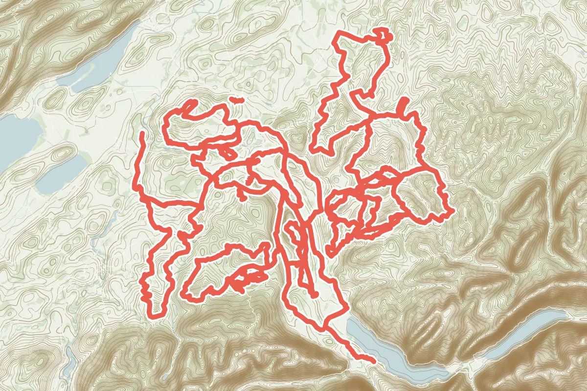
First come rides Bern is known for: Aare-Route, 50.3 km (31.3 mi) from Spiez to Bern; Grünes Band Bern, a loop of 58.0 km (36.0 mi); and Frienisberg Fernsichtroute, a loop of 40.9 km (25.4 mi). Of the 15 other tracks around the centre, 8 are for cycling and 7 for mountain bikes. The longest ride or track here is Herzschlaufe Burgdorf, 85.0 km (52.8 mi). 10 of them end where they start. Gürbe–Sense runs through the centre itself. Of those of 5 km or more, the hilliest is Herzschlaufe Burgdorf, with about 2,120 m of climb over 85.0 km (52.8 mi), and the flattest Bremerloop, with about 110 m. One long-distance route passes through as well: Alpenpanorama-Route.
How long
- 3 under 5 km (3 mi)
- 1 of 5 to 20 km (3 to 12 mi)
- 14 over 20 km (12 mi)
How hilly
- Rolling 5
- Hilly 10
By each one’s climb per kilometre: flat under 5 m (26 ft a mile), hilly from 15 m (79 ft a mile). Most climbs are estimated.
Popular rides in Bern
Chosen by Cycle Maps among the tracks mapped in OpenStreetMap: rides Bern is known for.
- Aare-Route Cycling track Rolling 50.3 km (31.3 mi) Spiez to Bern · About 270 m (890 ft) of climb · through the centre
- Grünes Band Bern Cycling track Rolling 58.0 km (36.0 mi) Loop · About 840 m (2,760 ft) of climb · 3.9 km (2.4 mi) from the centre
- Frienisberg Fernsichtroute Cycling track Hilly 40.9 km (25.4 mi) Loop · About 690 m (2,260 ft) of climb · 3.5 km (2.2 mi) from the centre
On the map
Each line is a track; tap one for its name.
Other tracks around Bern
- Herzschlaufe Burgdorf Cycling track Hilly 85.0 km (52.8 mi) Loop · About 2,120 m (6,960 ft) of climb · 8.8 km (5.5 mi) from the centre
- Herzschlaufe Sense Cycling track Hilly 72.0 km (44.7 mi) Loop · About 1,330 m (4,360 ft) of climb · 9.8 km (6.1 mi) from the centre
- Gürbe–Sense Cycling track Rolling 71.8 km (44.6 mi) Thun (Amsoldingen) to Kerzers (Golaten) · About 630 m (2,070 ft) of climb · through the centre
- Herzschlaufe Langnau Cycling track Hilly 67.6 km (42.0 mi) Loop · About 1,970 m (6,460 ft) of climb · 12.3 km (7.7 mi) from the centre
- Herzschlaufe Gotthelf Cycling track Hilly 60.4 km (37.5 mi) Loop · About 1,510 m (4,950 ft) of climb · 13.8 km (8.6 mi) from the centre
- Sagenroute Gantrisch Cycling track Hilly 49.0 km (30.4 mi) Loop · About 1,140 m (3,740 ft) of climb · 12.0 km (7.5 mi) from the centre
- Bern-Süd-Route Cycling track Rolling 41.3 km (25.6 mi) Bern to Riggisberg · About 600 m (1,970 ft) of climb · 124 m (407 ft) from the centre
- ZäziLoop Mountain-bike track Hilly 40.3 km (25.0 mi) Loop · About 1,300 m (4,270 ft) of climb · 15.8 km (9.8 mi) from the centre
- Kiesental-Loop Mountain-bike track Hilly 39.9 km (24.8 mi) Loop · About 1,230 m (4,040 ft) of climb · 13.3 km (8.3 mi) from the centre
- Belpbergroute Cycling track Hilly 30.6 km (19.0 mi) Loop · About 480 m (1,570 ft) of climb · 10.5 km (6.5 mi) from the centre
- Gibelegg Mountain-bike track Hilly 22.1 km (13.7 mi) Loop · About 760 m (2,490 ft) of climb · 15.5 km (9.6 mi) from the centre
- Bremerloop Mountain-bike track Rolling 7.6 km (4.7 mi) Loop · About 110 m (360 ft) of climb · 2.5 km (1.5 mi) from the centre
- Ulmizberg Trail Mountain-bike track 3.5 km (2.2 mi) About 270 m (890 ft) of climb · 4.5 km (2.8 mi) from the centre
- GurtenTrail 2.0 Mountain-bike track 2.5 km (1.5 mi) About 240 m (790 ft) of climb · 2.3 km (1.4 mi) from the centre
- Bärenried-Trail Mountain-bike track 2.1 km (1.3 mi) 8 m (26 ft) of climb · 8.9 km (5.5 mi) from the centre
Long-distance routes through Bern
Lengths and climbs are for the whole route.
About this list
OpenStreetMap has 38 tracks in or near the square searched around Bern; this page shows 3 popular rides, 15 tracks and 1 long-distance route. The centre is taken as 46.948° N, 7.4474° E, and the list was made on 1 November 2026. How the city lists are made.
Cities near Bern
- Lucerne Switzerland · 66 km (41 mi) away
- Zurich Switzerland · 95 km (59 mi) away
- Freiburg Germany · 120 km (75 mi) away
Find tracks anywhere with the app
Cycle Maps is an Android app that finds cycling and mountain-bike tracks near any spot on the map.