 Cycle Maps
Cycling routes and mountain-bike trails in Regensburg
Cycle Maps lists cycling routes and mountain-bike trails as tracks. 3 rides Regensburg is known for, then 15 other tracks within 16 km of the centre of Regensburg, Germany, longest first.
- 18 tracks
- 92.9 km (57.7 mi) the longest
- 529.1 km (328.7 mi) in all

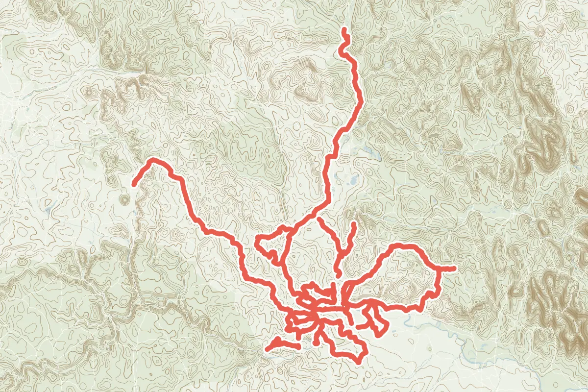
First come rides Regensburg is known for: Regensburg-Falkenstein-Radweg, 40.2 km (25.0 mi); Schwarze-Laber-Radweg, 84.3 km (52.4 mi) from Neumarkt in der Oberpfalz to Sinzing; and Naabtal-Radweg, 92.9 km (57.7 mi) from Unterwildenau to Regensburg. Of the 15 other tracks around the centre, 14 are for cycling and one for mountain bikes. The longest ride or track here is Naabtal-Radweg, 92.9 km (57.7 mi). 7 of them end where they start. The nearest to the centre is Radroute 5: Zwischen Regen und Naab, 679 m (2,228 ft) from it. Of those of 5 km or more, the hilliest is Schwarze-Laber-Radweg, with 873 m of climb over 84.3 km (52.4 mi), and the flattest Regenstauf-Hirschling, with almost none. 4 long-distance routes pass through as well: EuroVelo 6 - Atlantic - Black Sea, Danube Cycle Path, European Limes Cycling Route and D-Route 6 - Donauroute.
How people ride in Germany: a typical ride in Germany was 8.3 km (5.2 mi), at 16.0 km/h (10 mph) while moving, from the rides of 602 Cycle Maps riders in 2014–2022.
How long
- 2 under 5 km (3 mi)
- 7 of 5 to 20 km (3 to 12 mi)
- 9 over 20 km (12 mi)
How hilly
- Flat 4
- Rolling 10
- Hilly 2
By each one’s climb per kilometre: flat under 5 m (26 ft a mile), hilly from 15 m (79 ft a mile). Most climbs are estimated.
Popular rides in Regensburg
Chosen by Cycle Maps among the tracks mapped in OpenStreetMap: rides Regensburg is known for.
- Regensburg-Falkenstein-Radweg Cycling track Rolling 40.2 km (25.0 mi) About 500 m (1,640 ft) of climb · 2.7 km (1.7 mi) from the centre
- Schwarze-Laber-Radweg Cycling track Rolling 84.3 km (52.4 mi) Neumarkt in der Oberpfalz to Sinzing · 873 m (2,864 ft) of climb · 4.8 km (3.0 mi) from the centre
- Naabtal-Radweg Cycling track Rolling 92.9 km (57.7 mi) Unterwildenau to Regensburg · 474 m (1,555 ft) of climb · 4.6 km (2.9 mi) from the centre
On the map
Each line is a track; tap one for its name.
Other tracks around Regensburg
- Route 1: Durch den Vorwald Cycling track Rolling 77.1 km (47.9 mi) Loop · About 780 m (2,560 ft) of climb · 2.0 km (1.2 mi) from the centre
- Radrundwanderweg R9 Landkreis Regensburg Cycling track Rolling 41.6 km (25.8 mi) Loop · About 400 m (1,310 ft) of climb · 3.9 km (2.4 mi) from the centre
- Radwanderweg R3 (Landkreis Regensburg) Cycling track Rolling 34.8 km (21.6 mi) Loop · About 460 m (1,510 ft) of climb · 15.5 km (9.6 mi) from the centre
- Radroute 5: Zwischen Regen und Naab Cycling track Rolling 30.5 km (18.9 mi) Loop · About 270 m (890 ft) of climb · 679 m (2,228 ft) from the centre
- Radwanderweg R7 (Landkreis Regensburg) Cycling track Flat 26.8 km (16.6 mi) About 10 m (30 ft) of climb · 7.4 km (4.6 mi) from the centre
- Radrundwanderweg R8 Landkreis Regensburg Cycling track Rolling 26.5 km (16.4 mi) Loop · About 360 m (1,180 ft) of climb · 4.6 km (2.9 mi) from the centre
- Radroute Regenstauf - Ponholz - Burglengenfeld Cycling track Rolling 11.7 km (7.3 mi) About 100 m (330 ft) of climb · 12.3 km (7.6 mi) from the centre
- Radroute 12 Cycling track Flat 11.4 km (7.1 mi) BMW Werk to Wenzenbach · About 20 m (70 ft) of climb · 3.0 km (1.9 mi) from the centre
- Hauptradroute rr05 Cycling track Flat 9.0 km (5.6 mi) Großprüfening to Hohes Kreuz · About 20 m (70 ft) of climb · 771 m (2,530 ft) from the centre
- Goldrush (UrTrails Altmühltal) Mountain-bike track Hilly 8.5 km (5.3 mi) Loop · 244 m (801 ft) of climb · 15.0 km (9.3 mi) from the centre
- Regenstauf-Hirschling Cycling track Flat 8.4 km (5.2 mi) Regenstauf to Hirschling · Almost flat · 12.3 km (7.7 mi) from the centre
- Route 2: Zwischen Regen und Naab Cycling track Rolling 8.4 km (5.2 mi) Loop · About 50 m (160 ft) of climb · 7.0 km (4.3 mi) from the centre
- R (Frauenhäusl - D6) Cycling track Hilly 7.9 km (4.9 mi) About 150 m (490 ft) of climb · 12.4 km (7.7 mi) from the centre
- Radroute Regensburg - Zeitlarn Cycling track 4.7 km (2.9 mi) About 10 m (30 ft) of climb · 1.4 km (0.8 mi) from the centre
- Verbindung R9 Donauradweg Cycling track 4.3 km (2.7 mi) About 90 m (300 ft) of climb · 6.8 km (4.2 mi) from the centre
Long-distance routes through Regensburg
Lengths and climbs are for the whole route. A route made of other routes that states no length has none here: measured, it would count its variants too.
- EuroVelo 6 - Atlantic - Black Sea (EV6) International, cycling 4,450.0 km (2,765.1 mi) · on OpenStreetMap Nantes to Constanta · about 511 m (1,677 ft) from the centre
- Danube Cycle Path International, cycling · no length stated · on OpenStreetMap About 345 m (1,132 ft) from the centre OpenStreetMap: “International Danube Cyclepath from Donaueschingen to the Black Sea, Part of EV6”
- European Limes Cycling Route International, cycling · no length stated · on OpenStreetMap About 257 m (843 ft) from the centre
- D-Route 6 - Donauroute (D6) National, cycling · no length stated · on OpenStreetMap About 156 m (512 ft) from the centre
About this list
OpenStreetMap has 42 tracks in or near the square searched around Regensburg; this page shows 3 popular rides, 15 tracks and 4 long-distance routes. Each name is listed once: 1 track with the name of a ride above is left out. The centre is taken as 49.0195° N, 12.0974° E, and the list was made on 1 November 2026. How the city lists are made.
Cities near Regensburg
- Nuremberg Germany · 88 km (55 mi) away
- Munich Germany · 105 km (65 mi) away
- Salzburg Austria · 153 km (95 mi) away
- Stuttgart Germany · 215 km (134 mi) away
- Erfurt Germany · 231 km (143 mi) away
Find tracks anywhere with the app
Cycle Maps is an Android app that finds cycling and mountain-bike tracks near any spot on the map.