 Cycle Maps
Cycling routes and mountain-bike trails in Düsseldorf
Cycle Maps lists cycling routes and mountain-bike trails as tracks. 2 rides Düsseldorf is known for, then 17 other tracks within 16 km of the centre of Düsseldorf, Germany, longest first.
- 19 tracks
- 111.1 km (69.0 mi) the longest
- 553.0 km (343.6 mi) in all

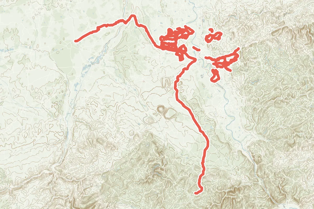
First come rides Düsseldorf is known for: Fietsallee am Nordkanal, 102.8 km (63.9 mi); and Erft-Radweg, 111.1 km (69.0 mi). Of the 17 other tracks around the centre, 16 are for cycling and one for mountain bikes. The longest ride or track here is Erft-Radweg, 111.1 km (69.0 mi). 4 of them end where they start. The nearest to the centre is Radleitroute 2, 887 m (2,910 ft) from it. Most of them lie west of the centre. Of those of 5 km or more, the hilliest is Erft-Radweg, with about 500 m of climb over 111.1 km (69.0 mi), and the flattest Kunst- und Denkmalroute (Nord), with almost none. 3 long-distance routes pass through as well: EuroVelo 3 - La Route des Pèlerins, EuroVelo 15 - Rheinradweg and EuroVelo 4 - Central Europe Route.
How people ride in Germany: a typical ride in Germany was 8.3 km (5.2 mi), at 16.0 km/h (10 mph) while moving, from the rides of 602 Cycle Maps riders in 2014–2022.
How long
- 2 under 5 km (3 mi)
- 5 of 5 to 20 km (3 to 12 mi)
- 12 over 20 km (12 mi)
How hilly
- Flat 11
- Rolling 5
- Hilly 1
By each one’s climb per kilometre: flat under 5 m (26 ft a mile), hilly from 15 m (79 ft a mile). Most climbs are estimated.
Popular rides in Düsseldorf
Chosen by Cycle Maps among the tracks mapped in OpenStreetMap: rides Düsseldorf is known for.
- Fietsallee am Nordkanal Cycling track Flat 102.8 km (63.9 mi) About 110 m (360 ft) of climb · 5.6 km (3.5 mi) from the centre
- Erft-Radweg Cycling track Flat 111.1 km (69.0 mi) About 500 m (1,640 ft) of climb · 5.6 km (3.5 mi) from the centre
On the map
Each line is a track; tap one for its name.
Other tracks around Düsseldorf
- Radrundwanderweg Willich Cycling track Flat 41.0 km (25.5 mi) Loop · About 20 m (70 ft) of climb · 13.6 km (8.4 mi) from the centre
- Ratinger Radrundwanderweg Cycling track Rolling 31.5 km (19.6 mi) About 320 m (1,050 ft) of climb · 6.5 km (4.0 mi) from the centre
- Radroute Krefeld R4 Cycling track Flat 30.5 km (18.9 mi) Almost flat · 10.7 km (6.6 mi) from the centre
- Radroute Krefeld R5 Cycling track Flat 28.5 km (17.7 mi) About 30 m (100 ft) of climb · 11.2 km (7.0 mi) from the centre
- Radroute Krefeld R7 Cycling track Flat 27.4 km (17.0 mi) About 10 m (30 ft) of climb · 14.9 km (9.3 mi) from the centre
- Veloroute VR1 Hilden-Ohligs-Wald-Vohwinkel Cycling track Rolling 25.2 km (15.6 mi) D-Benrath to W-Vohwinkel · About 220 m (720 ft) of climb · 10.4 km (6.4 mi) from the centre
- Expressroute Wuppertal-Düsseldorf Cycling track Rolling 24.9 km (15.4 mi) Wuppertal-Vohwinkel to Düsseldorf · About 210 m (690 ft) of climb · 4.8 km (3.0 mi) from the centre
- Stadt-Land-Fluss-Tour Cycling track Flat 24.5 km (15.2 mi) About 50 m (160 ft) of climb · 12.8 km (8.0 mi) from the centre
- Radweg Rund um Hilden Cycling track Rolling 23.4 km (14.6 mi) Loop · About 140 m (460 ft) of climb · 10.1 km (6.3 mi) from the centre
- bienenACHT Cycling track Flat 23.1 km (14.4 mi) Almost flat · 14.4 km (8.9 mi) from the centre
- Kunst- und Denkmalroute (Süd) Cycling track Flat 17.1 km (10.6 mi) Loop · Almost flat · 10.5 km (6.5 mi) from the centre
- Kunst- und Denkmalroute (Nordschleife) Cycling track Flat 11.3 km (7.0 mi) Almost flat · 8.2 km (5.1 mi) from the centre
- Solingen Route Lochbachtal-Ohligs-Engelsberger Hof Cycling track Hilly 10.0 km (6.2 mi) About 180 m (590 ft) of climb · 15.9 km (9.9 mi) from the centre
- Radverkehrsnetz NRW: Nesselrath-Wiescheid-Heide-HildenOst Cycling track Rolling 6.8 km (4.2 mi) About 60 m (200 ft) of climb · 14.8 km (9.2 mi) from the centre
- Kunst- und Denkmalroute (Nord) Cycling track Flat 6.4 km (4.0 mi) Loop · Almost flat · 10.7 km (6.7 mi) from the centre
- Radleitroute 2 Cycling track 4.4 km (2.7 mi) Lörick to Gerresheim · Almost flat · 887 m (2,910 ft) from the centre
- Trail Dickels- und Steinsiepenbach Mountain-bike track 3.0 km (1.9 mi) Almost flat · 12.5 km (7.8 mi) from the centre
Long-distance routes through Düsseldorf
Lengths and climbs are for the whole route. A route made of other routes that states no length has none here: measured, it would count its variants too.
- EuroVelo 3 - La Route des Pèlerins (EV3) International, cycling · no length stated · on OpenStreetMap About 222 m (728 ft) from the centre
- EuroVelo 15 - Rheinradweg (EV15) International, cycling 1,230.0 km (764.3 mi) · on OpenStreetMap About 994 m (3,261 ft) from the centre
- EuroVelo 4 - Central Europe Route (EV4) International, cycling 5,100.0 km (3,169.0 mi) · on OpenStreetMap About 2.3 km (1.4 mi) from the centre
About this list
OpenStreetMap has 237 tracks in or near the square searched around Düsseldorf; this page shows 2 popular rides, 17 tracks and 3 long-distance routes. The centre is taken as 51.2277° N, 6.7735° E, and the list was made on 1 November 2026. How the city lists are made.
Cities near Düsseldorf
- Cologne Germany · 35 km (22 mi) away
- Münster Germany · 101 km (63 mi) away
- Utrecht Netherlands · 149 km (93 mi) away
- Trier Germany · 164 km (102 mi) away
- Mainz Germany · 172 km (107 mi) away
Find tracks anywhere with the app
Cycle Maps is an Android app that finds cycling and mountain-bike tracks near any spot on the map.