 Cycle Maps
Mountain-bike trails and cycling routes in Trier
Cycle Maps lists mountain-bike trails and cycling routes as tracks. 3 rides Trier is known for, then 16 other tracks within 16 km of the centre of Trier, Germany, longest first.
- 19 tracks
- 122.8 km (76.3 mi) the longest
- 738.0 km (458.5 mi) in all

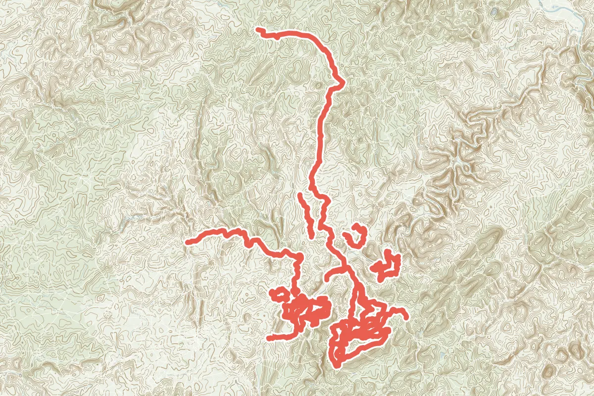
First come rides Trier is known for: Ruwer-Hochwald-Radweg, 54.5 km (33.9 mi); Sauer-Radweg, 60.8 km (37.8 mi); and Kylltal-Radweg, 122.8 km (76.3 mi). Of the 16 other tracks around the centre, 12 are for mountain bikes and 4 for cycling. The longest ride or track here is Kylltal-Radweg, 122.8 km (76.3 mi). 8 of them end where they start. The nearest to the centre is MTB-Tour 2 "Galgenberg", 5.6 km (3.5 mi) from it. Most of them lie south of the centre. Of those of 5 km or more, the hilliest is Kylltal-Radweg, with about 1,550 m of climb over 122.8 km (76.3 mi), and the flattest Radweg Wiltinger Saarbogen, with about 70 m. 4 long-distance routes pass through as well: VeloRoute SaarLorLux, Mosel-Radweg, Radroute Saar-Mosel-Main and Piste cyclable des trois rivières.
How people ride in Germany: a typical ride in Germany was 8.3 km (5.2 mi), at 16.0 km/h (10 mph) while moving, from the rides of 602 Cycle Maps riders in 2014–2022.
How long
- 5 of 5 to 20 km (3 to 12 mi)
- 14 over 20 km (12 mi)
How hilly
- Rolling 7
- Hilly 12
By each one’s climb per kilometre: flat under 5 m (26 ft a mile), hilly from 15 m (79 ft a mile). Most climbs are estimated.
Popular rides in Trier
Chosen by Cycle Maps among the tracks mapped in OpenStreetMap: rides Trier is known for.
- Ruwer-Hochwald-Radweg Cycling track Rolling 54.5 km (33.9 mi) About 630 m (2,070 ft) of climb · 987 m (3,238 ft) from the centre
- Sauer-Radweg Cycling track Rolling 60.8 km (37.8 mi) About 370 m (1,210 ft) of climb · 8.6 km (5.4 mi) from the centre
- Kylltal-Radweg Cycling track Rolling 122.8 km (76.3 mi) About 1,550 m (5,090 ft) of climb · 933 m (3,061 ft) from the centre
On the map
Each line is a track; tap one for its name.
Other tracks around Trier
- Fit über den Rücken des Hochwaldes Mountain-bike track Hilly 58.4 km (36.3 mi) Loop · About 880 m (2,890 ft) of climb · 15.5 km (9.6 mi) from the centre
- Keller Rad-Aktiv-Route Mountain-bike track Rolling 55.7 km (34.6 mi) Loop · About 820 m (2,690 ft) of climb · 15.5 km (9.6 mi) from the centre
- MTB 2 (schwarz) "Berg- und Talsperren-Tour" Mountain-bike track Hilly 53.0 km (32.9 mi) Loop · About 1,060 m (3,480 ft) of climb · 8.6 km (5.4 mi) from the centre
- MTB 3 Moselhöhen Mountain-bike track Hilly 44.6 km (27.7 mi) Loop · About 1,000 m (3,280 ft) of climb · 11.9 km (7.4 mi) from the centre
- Ruwer Rad-Aktiv-Route Mountain-bike track Hilly 43.3 km (26.9 mi) Loop · About 920 m (3,020 ft) of climb · 7.6 km (4.7 mi) from the centre
- Neun Dörfer im Dunstkreis der Burg Heid Mountain-bike track Hilly 34.7 km (21.6 mi) About 760 m (2,490 ft) of climb · 12.5 km (7.7 mi) from the centre
- Mountainbike-Tour 4 "Grana-Tour" Mountain-bike track Hilly 33.1 km (20.6 mi) About 680 m (2,230 ft) of climb · 8.1 km (5.0 mi) from the centre
- Mountainbike-Tour 3 "Merkur" Mountain-bike track Hilly 31.9 km (19.8 mi) Loop · About 590 m (1,940 ft) of climb · 8.1 km (5.0 mi) from the centre
- MTB-Tour 2 "Galgenberg" Mountain-bike track Hilly 28.0 km (17.4 mi) About 550 m (1,800 ft) of climb · 5.6 km (3.5 mi) from the centre
- MTB 4 - Tour der schönen Aussichten Mountain-bike track Hilly 21.4 km (13.3 mi) Loop · About 360 m (1,180 ft) of climb · 13.1 km (8.1 mi) from the centre
- Saargau-Radweg Cycling track Hilly 21.3 km (13.2 mi) 380 m (1,247 ft) of climb · 8.1 km (5.0 mi) from the centre
- MTB Manternach Mountain-bike track Hilly 18.4 km (11.4 mi) Loop · About 400 m (1,310 ft) of climb · 12.2 km (7.6 mi) from the centre
- Gutland-Radweg Cycling track Rolling 17.6 km (11.0 mi) About 230 m (750 ft) of climb · 12.4 km (7.7 mi) from the centre
- MTB 2 Mountain-bike track Hilly 17.6 km (10.9 mi) About 460 m (1,510 ft) of climb · 11.0 km (6.8 mi) from the centre
- Konzer Tälchen Radweg Cycling track Rolling 13.7 km (8.5 mi) About 120 m (390 ft) of climb · 6.8 km (4.2 mi) from the centre
- Radweg Wiltinger Saarbogen Cycling track Rolling 7.2 km (4.5 mi) About 70 m (230 ft) of climb · 10.4 km (6.4 mi) from the centre
Long-distance routes through Trier
Lengths and climbs are for the whole route. A route made of other routes that states no length has none here: measured, it would count its variants too.
- VeloRoute SaarLorLux (SLL) International, cycling 365.1 km (226.9 mi) · on OpenStreetMap About 561 m (1,841 ft) from the centre
- Mosel-Radweg National, cycling 273.1 km (169.7 mi) · its page in German About 948 m (3,110 ft) from the centre
- Radroute Saar-Mosel-Main (D5) National, cycling · no length stated · on OpenStreetMap About 948 m (3,110 ft) from the centre
- Piste cyclable des trois rivières (PC 3) National, cycling 89.9 km (55.9 mi) 8.8 km (5.5 mi) from the centre
About this list
OpenStreetMap has 47 tracks in or near the square searched around Trier; this page shows 3 popular rides, 16 tracks and 4 long-distance routes. One track shorter than 1 km is left out. The centre is taken as 49.7557° N, 6.6394° E, and the list was made on 1 November 2026. How the city lists are made.
Cities near Trier
- Mainz Germany · 118 km (73 mi) away
- Cologne Germany · 133 km (83 mi) away
- Frankfurt Germany · 151 km (94 mi) away
- Karlsruhe Germany · 152 km (95 mi) away
- Heidelberg Germany · 153 km (95 mi) away
Find tracks anywhere with the app
Cycle Maps is an Android app that finds cycling and mountain-bike tracks near any spot on the map.