 Cycle Maps
Cycling routes and mountain-bike trails in Lyon
Cycle Maps lists cycling routes and mountain-bike trails as tracks. 3 rides Lyon is known for, then 21 other tracks within 16 km of the centre of Lyon, France, longest first.
- 24 tracks
- 50.6 km (31.4 mi) the longest
- 454.9 km (282.7 mi) in all

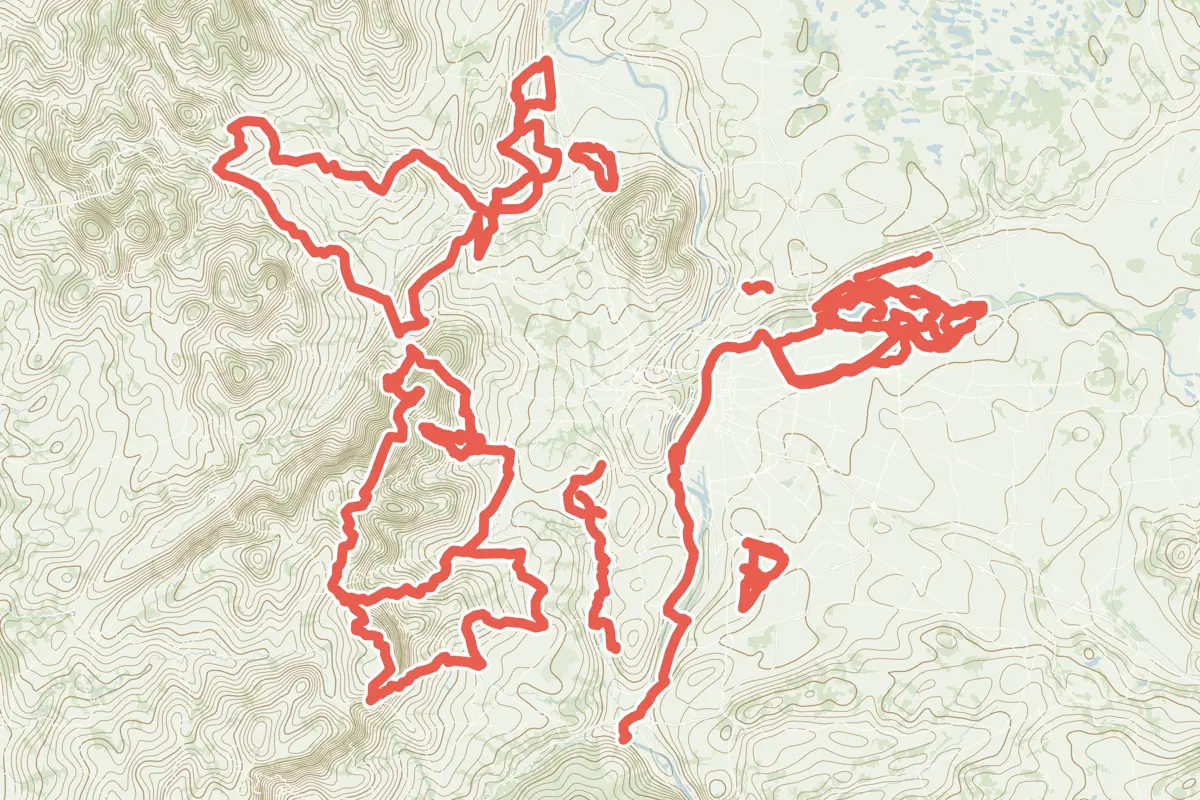
First come rides Lyon is known for: Voie Verte des Berges du Rhône à Lyon, 16.8 km (10.4 mi); L'Anneau Bleu Piste Mode Doux, a loop of 30.2 km (18.7 mi); and EuroVélo 17 - 20: Lyon – Givors, 24.9 km (15.5 mi) from Lyon to Givors. Of the 21 other tracks around the centre, 12 are for mountain bikes and 9 for cycling. The longest ride or track here is Le Grand Tour, 50.6 km (31.4 mi). 12 of them end where they start. The nearest to the centre is Voie Lyonnaise numéro 1, 440 m (1,444 ft) from it. Of those of 5 km or more, the hilliest is Le Grand Tour, with 790 m of climb over 50.6 km (31.4 mi), and the flattest Voie Lyonnaise numéro 1, with about 20 m. One long-distance route passes through as well: La Voie Bleue.
How people ride in France: a typical ride in France was 8.7 km (5.4 mi), at 14.8 km/h (9 mph) while moving, from the rides of 727 Cycle Maps riders in 2014–2022.
How long
- 1 under 5 km (3 mi)
- 13 of 5 to 20 km (3 to 12 mi)
- 10 over 20 km (12 mi)
How hilly
- Flat 10
- Rolling 7
- Hilly 6
By each one’s climb per kilometre: flat under 5 m (26 ft a mile), hilly from 15 m (79 ft a mile). Most climbs are estimated.
Popular rides in Lyon
Chosen by Cycle Maps among the tracks mapped in OpenStreetMap: rides Lyon is known for.
- Voie Verte des Berges du Rhône à Lyon Cycling track Flat 16.8 km (10.4 mi) About 30 m (100 ft) of climb · 409 m (1,342 ft) from the centre
- L'Anneau Bleu Piste Mode Doux Cycling track Flat 30.2 km (18.7 mi) Loop · About 20 m (70 ft) of climb · 4.9 km (3.1 mi) from the centre
- EuroVélo 17 - 20: Lyon – Givors Cycling track Flat 24.9 km (15.5 mi) Lyon to Givors · About 90 m (300 ft) of climb · 1.3 km (0.8 mi) from the centre
On the map
Each line is a track; tap one for its name.
Other tracks around Lyon
- Le Grand Tour Mountain-bike track Hilly 50.6 km (31.4 mi) Loop · 790 m (2,592 ft) of climb · 9.0 km (5.6 mi) from the centre
- Circuit VTT n°5 Miribel : le Milieu Mountain-bike track Flat 28.8 km (17.9 mi) Loop · About 50 m (160 ft) of climb · 8.3 km (5.2 mi) from the centre
- Les Lapins Mountain-bike track Hilly 27.1 km (16.9 mi) Loop · 501 m (1,644 ft) of climb · 9.9 km (6.2 mi) from the centre
- Voie Lyonnaise numéro 10 Cycling track Rolling 23.2 km (14.4 mi) Tassin to Meyzieu · About 160 m (520 ft) of climb · 984 m (3,228 ft) from the centre
- L'aqueduc romain du Gier Mountain-bike track Hilly 23.2 km (14.4 mi) Loop · 349 m (1,145 ft) of climb · 7.2 km (4.5 mi) from the centre
- La Vallée en Barret Mountain-bike track Hilly 20.6 km (12.8 mi) Loop · 321 m (1,053 ft) of climb · 9.0 km (5.6 mi) from the centre
- Voie Lyonnaise numéro 7 Cycling track Rolling 20.4 km (12.7 mi) Rillieux-la-Pape to Feyzin · About 160 m (520 ft) of climb · 1.2 km (0.7 mi) from the centre
- Voie Lyonnaise numéro 5 Cycling track Rolling 20.4 km (12.7 mi) Bron to Pont Poincaré · About 150 m (490 ft) of climb · 984 m (3,228 ft) from the centre
- Circuit VTT n°4 Miribel : la Forestière Mountain-bike track Flat 18.5 km (11.5 mi) Loop · About 40 m (130 ft) of climb · 8.8 km (5.5 mi) from the centre
- Voie Lyonnaise numéro 8 Cycling track Rolling 18.4 km (11.4 mi) La-Tour-de-Salvagny to Saint-Priest · About 270 m (890 ft) of climb · 715 m (2,346 ft) from the centre
- Le Pont de Chêne Mountain-bike track Hilly 18.3 km (11.3 mi) Loop · 400 m (1,312 ft) of climb · 6.2 km (3.9 mi) from the centre
- Voie Lyonnaise numéro 4 Cycling track Hilly 16.3 km (10.1 mi) Monts d'Or to Villeurbanne · About 260 m (850 ft) of climb · 984 m (3,228 ft) from the centre
- Voie Lyonnaise numéro 9 Cycling track Flat 15.7 km (9.8 mi) Oullins to Jonage · About 20 m (70 ft) of climb · 1.2 km (0.7 mi) from the centre
- Voie Lyonnaise numéro 2 Cycling track Flat 13.8 km (8.6 mi) Cailloux to Mions · About 40 m (130 ft) of climb · 1.7 km (1.1 mi) from the centre
- Circuit VTT n°2 Miribel : les Bois Mountain-bike track Flat 12.7 km (7.9 mi) Loop · About 30 m (100 ft) of climb · 8.3 km (5.2 mi) from the centre
- Le Plateau Mountain-bike track Rolling 11.9 km (7.4 mi) Loop · 117 m (384 ft) of climb · 9.3 km (5.8 mi) from the centre
- Voie Lyonnaise numéro 11 Cycling track Rolling 11.0 km (6.8 mi) Craponne to Chassieu · About 110 m (360 ft) of climb · 464 m (1,522 ft) from the centre
- Les gônes Mountain-bike track Rolling 10.5 km (6.6 mi) Loop · About 140 m (460 ft) of climb · 8.7 km (5.4 mi) from the centre
- Circuit VTT n°3 Miribel : Tour du lac Mountain-bike track Flat 10.1 km (6.3 mi) Loop · About 30 m (100 ft) of climb · 8.8 km (5.5 mi) from the centre
- Voie Lyonnaise numéro 1 Cycling track Flat 8.3 km (5.2 mi) Vaulx-en-Velin to Saint-Fons · About 20 m (70 ft) of climb · 440 m (1,444 ft) from the centre
- Circuit VTT n°1 Miribel : le Morlet Mountain-bike track 3.3 km (2.1 mi) Loop · Almost flat · 8.3 km (5.1 mi) from the centre
Long-distance routes through Lyon
Lengths and climbs are for the whole route.
About this list
OpenStreetMap has 107 tracks in or near the square searched around Lyon; this page shows 3 popular rides, 21 tracks and 1 long-distance route. The centre is taken as 45.764° N, 4.8357° E, and the list was made on 24 October 2026. How the city lists are made.
Cities near Lyon
- Bern Switzerland · 240 km (149 mi) away
- Lucerne Switzerland · 302 km (188 mi) away
- Zurich Switzerland · 335 km (208 mi) away
- Paris France · 391 km (243 mi) away
Find tracks anywhere with the app
Cycle Maps is an Android app that finds cycling and mountain-bike tracks near any spot on the map.