 Cycle Maps
Cycling routes and mountain-bike trails in Brussels
Cycle Maps lists cycling routes and mountain-bike trails as tracks. 3 rides Brussels is known for, then 23 other tracks within 16 km of the centre of Brussels, Belgium, longest first.
- 26 tracks
- 126.1 km (78.4 mi) the longest
- 511.7 km (317.9 mi) in all

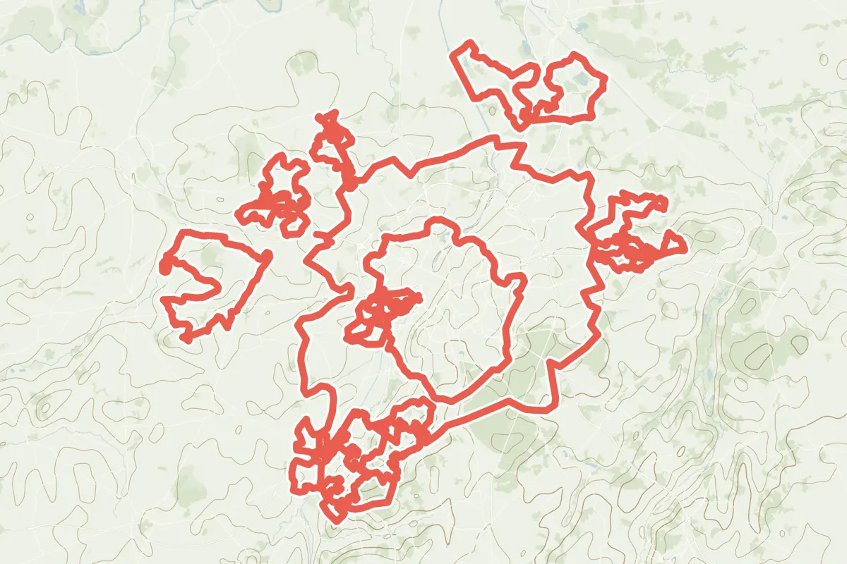
First come rides Brussels is known for: Promenade verte - Groene wandeling, a loop of 58.7 km (36.5 mi); Groene Gordelroute, a loop of 126.1 km (78.4 mi); and Lambiek-Geuzeroute, a loop of 41.2 km (25.6 mi). Of the 23 other tracks around the centre, 12 are for cycling and 11 for mountain bikes. The longest ride or track here is Groene Gordelroute, 126.1 km (78.4 mi). 5 of them end where they start. The nearest to the centre is A1 Itinéraire cycliste communal - Gemeentelijke fietsroute, 1.3 km (0.8 mi) from it. Most of them lie west of the centre. Of those of 5 km or more, the hilliest is Groene Gordelroute, with about 790 m of climb over 126.1 km (78.4 mi), and the flattest A1 Itinéraire cycliste communal - Gemeentelijke fietsroute, with about 30 m. 3 long-distance routes pass through as well: EuroVelo 5 - Via Romea Francigena, Heuvelroute and Vlaanderenroute.
How long
- 11 under 5 km (3 mi)
- 6 of 5 to 20 km (3 to 12 mi)
- 9 over 20 km (12 mi)
How hilly
- Flat 5
- Rolling 9
- Hilly 1
By each one’s climb per kilometre: flat under 5 m (26 ft a mile), hilly from 15 m (79 ft a mile). Most climbs are estimated.
Popular rides in Brussels
Chosen by Cycle Maps among the tracks mapped in OpenStreetMap: rides Brussels is known for.
- Promenade verte - Groene wandeling Cycling track Rolling 58.7 km (36.5 mi) Loop · About 480 m (1,570 ft) of climb · 3.6 km (2.2 mi) from the centre
- Groene Gordelroute Cycling track Rolling 126.1 km (78.4 mi) Loop · About 790 m (2,590 ft) of climb · 6.1 km (3.8 mi) from the centre
- Lambiek-Geuzeroute Cycling track Rolling 41.2 km (25.6 mi) Loop · About 340 m (1,120 ft) of climb · 8.2 km (5.1 mi) from the centre
On the map
Each line is a track; tap one for its name.
Other tracks around Brussels
- Miel Van Cauter route Meise Mountain-bike track Flat 43.9 km (27.3 mi) Loop · About 210 m (690 ft) of climb · 8.2 km (5.1 mi) from the centre
- Leeuwse Route Mountain-bike track Rolling 39.5 km (24.6 mi) About 210 m (690 ft) of climb · 6.9 km (4.3 mi) from the centre
- MTB Hoeilaart Nero Mountain-bike track Rolling 24.2 km (15.0 mi) About 240 m (790 ft) of climb · 9.3 km (5.8 mi) from the centre
- Feestroute Merchtem Mountain-bike track Rolling 23.3 km (14.5 mi) Loop · About 120 m (390 ft) of climb · 9.7 km (6.0 mi) from the centre
- Vliegeniersroute Zaventem Cycling track Flat 22.1 km (13.7 mi) Loop · About 100 m (330 ft) of climb · 6.9 km (4.3 mi) from the centre
- Asse rood Mountain-bike track Rolling 20.6 km (12.8 mi) Loop · About 230 m (750 ft) of climb · 10.7 km (6.7 mi) from the centre
- Groene Route Beersel Mountain-bike track Hilly 19.7 km (12.2 mi) About 370 m (1,210 ft) of climb · 10.0 km (6.2 mi) from the centre
- Asse groen Mountain-bike track Rolling 15.6 km (9.7 mi) About 140 m (460 ft) of climb · 11.4 km (7.1 mi) from the centre
- Sint-Pieters-Leeuw green Mountain-bike track Flat 14.0 km (8.7 mi) 60 m (197 ft) of climb · 6.9 km (4.3 mi) from the centre
- MTB Tervuren blue Mountain-bike track Rolling 13.4 km (8.4 mi) Loop · About 110 m (360 ft) of climb · 9.3 km (5.8 mi) from the centre
- Sint-Pieters-Leeuw blue Mountain-bike track Flat 13.4 km (8.3 mi) 52 m (171 ft) of climb · 9.8 km (6.1 mi) from the centre
- A1 Itinéraire cycliste communal - Gemeentelijke fietsroute Cycling track Flat 7.2 km (4.5 mi) About 30 m (100 ft) of climb · 1.3 km (0.8 mi) from the centre
- A5 Itinéraire cycliste communal - Gemeentelijke fietsroute Cycling track 4.6 km (2.8 mi) About 40 m (130 ft) of climb · 1.4 km (0.8 mi) from the centre
- A4 Itinéraire cycliste communal - Gemeentelijke fietsroute Cycling track 3.6 km (2.2 mi) About 30 m (100 ft) of climb · 1.8 km (1.1 mi) from the centre
- ICC2/GemFR2 Itinéraire cycliste communal - Gemeentelijke fietsroute Cycling track 2.9 km (1.8 mi) About 20 m (70 ft) of climb · 1.8 km (1.1 mi) from the centre
- A3 Itinéraire cycliste communal - Gemeentelijke fietsroute Cycling track 2.8 km (1.7 mi) About 20 m (70 ft) of climb · 4.1 km (2.6 mi) from the centre
- A6 Itinéraire cycliste communal - Gemeentelijke fietsroute Cycling track 2.5 km (1.6 mi) About 40 m (130 ft) of climb · 3.8 km (2.3 mi) from the centre
- ICC4/GemFR4 Itinéraire cycliste communal - Gemeentelijke fietsroute Cycling track 2.3 km (1.4 mi) About 40 m (130 ft) of climb · 2.5 km (1.6 mi) from the centre
- A2 Itinéraire cycliste communal - Gemeentelijke fietsroute Cycling track 2.2 km (1.4 mi) Almost flat · 4.6 km (2.8 mi) from the centre
- A7 Itinéraire cycliste communal - Gemeentelijke fietsroute Cycling track 2.2 km (1.4 mi) About 30 m (100 ft) of climb · 3.1 km (1.9 mi) from the centre
- ICC3/GemFR3 Itinéraire cycliste communal - Gemeentelijke fietsroute Cycling track 2.1 km (1.3 mi) About 50 m (160 ft) of climb · 3.6 km (2.2 mi) from the centre
- ICC1/GemFR1 Itinéraire cycliste communal - Gemeentelijke fietsroute Cycling track 1.9 km (1.2 mi) About 10 m (30 ft) of climb · 2.7 km (1.7 mi) from the centre
- Dilbeek Blauw Mountain-bike track 1.6 km (1.0 mi) About 20 m (70 ft) of climb · 8.4 km (5.2 mi) from the centre
Long-distance routes through Brussels
Lengths and climbs are for the whole route.
- EuroVelo 5 - Via Romea Francigena (EV5) International, cycling 3,900.0 km (2,423.3 mi) · on OpenStreetMap Canterbury, Canterbury Cathedral to Brindisi · about 114 m (374 ft) from the centre
- Heuvelroute National, cycling 459.0 km (285.2 mi) · on OpenStreetMap Poperinge to Voeren · about 9.8 km (6.1 mi) from the centre
- Vlaanderenroute (VL) National, cycling 952.0 km (591.5 mi) · on OpenStreetMap Loop · about 9.9 km (6.1 mi) from the centre
About this list
OpenStreetMap has 155 tracks in or near the square searched around Brussels; this page shows 3 popular rides, 23 tracks and 3 long-distance routes. Each name is listed once: 1 track with the name of a ride above is left out. The centre is taken as 50.8467° N, 4.3525° E, and the list was made on 24 October 2026. How the city lists are made.
Cities near Brussels
- Utrecht Netherlands · 148 km (92 mi) away
- Amsterdam Netherlands · 174 km (108 mi) away
- Düsseldorf Germany · 174 km (108 mi) away
Find tracks anywhere with the app
Cycle Maps is an Android app that finds cycling and mountain-bike tracks near any spot on the map.