 Cycle Maps
Cycling routes in Lisbon
Cycle Maps lists cycling routes as tracks. 2 rides Lisbon is known for, then 8 other tracks within 16 km of the centre of Lisbon, Portugal, longest first.
- 10 tracks
- 20.9 km (13.0 mi) the longest
- 62.6 km (38.9 mi) in all

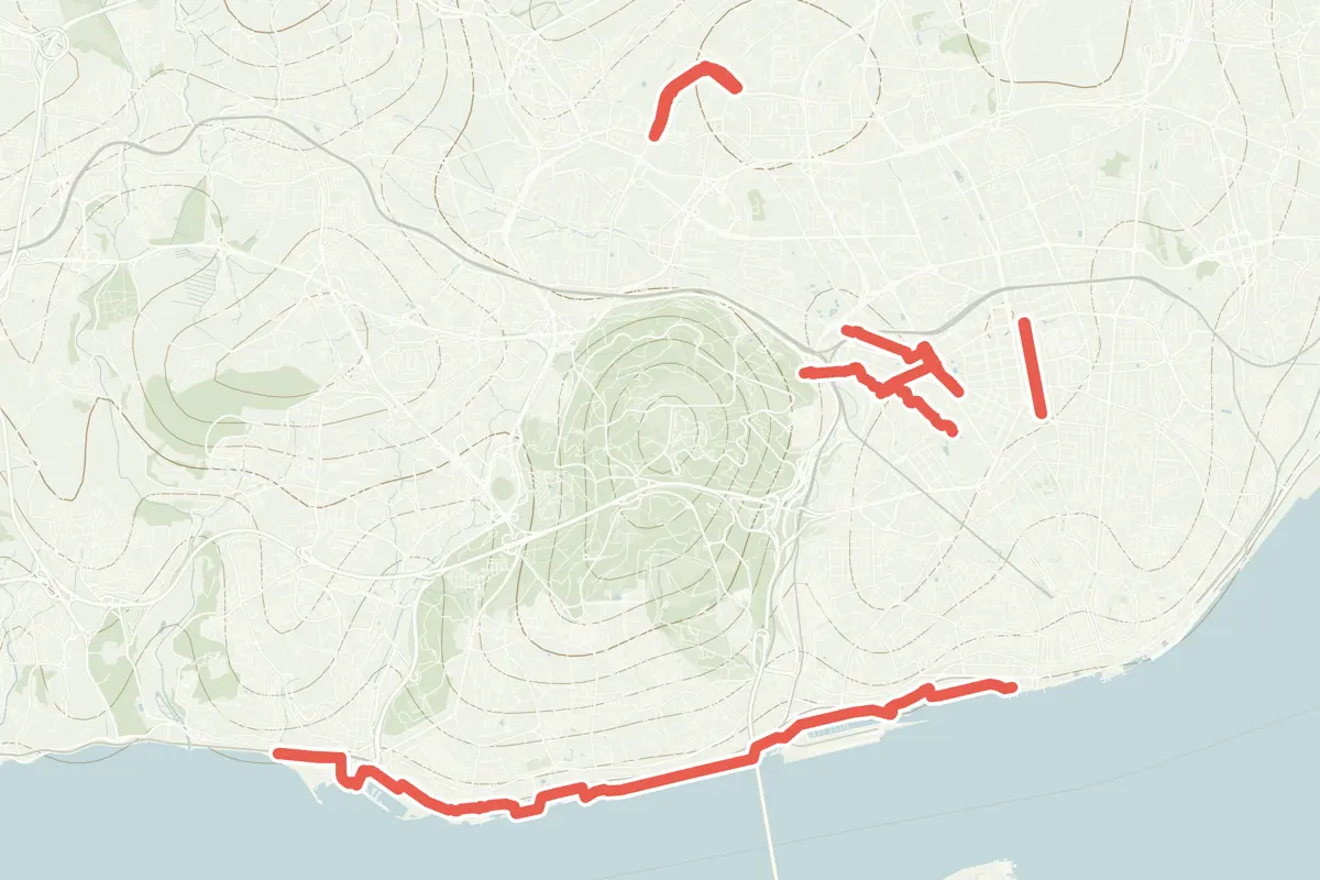
First come rides Lisbon is known for: Tagus riverside: Cais do Sodré – Algés, 10.6 km (6.6 mi); and Corredor Verde Monsanto-Parque Eduardo VII, 2.1 km (1.3 mi). The longest ride or track here is Eixos principais CML - Eixo Marginal, 20.9 km (13.0 mi). 2 of them end where they start. The nearest to the centre is Eixos principais CML - Eixo Central, 608 m (1,995 ft) from it. Most of them lie north of the centre. Of those of 5 km or more, the hilliest is Eixos principais CML - Eixo Benfica - Braço de Prata, with about 120 m of climb over 10.7 km (6.7 mi), and the flattest Eixos principais CML - Eixo Marginal, with almost none. 2 long-distance routes pass through as well: EuroVelo 1 - Atlantic Coast Route and Ecovia 11 (Lisboa - Badajoz).
How long
- 6 under 5 km (3 mi)
- 3 of 5 to 20 km (3 to 12 mi)
- 1 over 20 km (12 mi)
How hilly
- Flat 2
- Rolling 2
By each one’s climb per kilometre: flat under 5 m (26 ft a mile), hilly from 15 m (79 ft a mile). Most climbs are estimated.
Popular rides in Lisbon
Chosen by Cycle Maps among the tracks mapped in OpenStreetMap: rides Lisbon is known for.
- Tagus riverside: Cais do Sodré – Algés Cycling track Flat 10.6 km (6.6 mi) The longest stretch of the route “EuroVelo 1 - Atlantic Coast Route - part Portugal 9” within 16 km of the centre · Almost flat · 2.0 km (1.2 mi) from the centre
- Corredor Verde Monsanto-Parque Eduardo VII Cycling track 2.1 km (1.3 mi) About 50 m (160 ft) of climb · 1.6 km (1.0 mi) from the centre
On the map
Each line is a track; tap one for its name.
Other tracks around Lisbon
- Eixos principais CML - Eixo Marginal Cycling track Flat 20.9 km (13.0 mi) Almost flat · 1.7 km (1.0 mi) from the centre
- Eixos principais CML - Eixo Benfica - Braço de Prata Cycling track Rolling 10.7 km (6.7 mi) About 120 m (390 ft) of climb · 1.4 km (0.9 mi) from the centre
- Eixos principais CML - Eixo Central Cycling track Rolling 9.1 km (5.7 mi) About 70 m (230 ft) of climb · 608 m (1,995 ft) from the centre
- Ciclovia Avenida Calouste Gulbenkian - Praça de Espanha Cycling track 2.6 km (1.6 mi) About 20 m (70 ft) of climb · 1.8 km (1.1 mi) from the centre
- Ciclovia Avenida 24 de Julho Cycling track 2.4 km (1.5 mi) About 20 m (70 ft) of climb · 1.8 km (1.1 mi) from the centre
- Ciclovia Avenida Defensores de Chaves Cycling track 2.0 km (1.3 mi) Loop · About 10 m (30 ft) of climb · 1.2 km (0.7 mi) from the centre
- Ciclovia Rua Pinheiro Chagas Cycling track 1.1 km (0.7 mi) Loop · About 20 m (70 ft) of climb · 1.3 km (0.8 mi) from the centre
- Ciclovia Rua Marquês de Fronteira Cycling track 1.1 km (0.7 mi) About 40 m (130 ft) of climb · 1.8 km (1.1 mi) from the centre
Long-distance routes through Lisbon
Lengths and climbs are for the whole route. A route made of other routes that states no length has none here: measured, it would count its variants too.
- EuroVelo 1 - Atlantic Coast Route (EV1) International, cycling · no length stated · on OpenStreetMap About 2.8 km (1.8 mi) from the centre
- Ecovia 11 (Lisboa - Badajoz) National, cycling 332.0 km (206.3 mi) · on OpenStreetMap About 11.6 km (7.2 mi) from the centre
About this list
OpenStreetMap has 103 tracks in or near the square searched around Lisbon; this page shows 2 popular rides, 8 tracks and 2 long-distance routes. 6 tracks shorter than 1 km are left out. 3 tracks under 2 km named for a street are left out. The centre is taken as 38.7223° N, 9.1393° W, and the list was made on 24 October 2026. How the city lists are made.
Cities near Lisbon
- Madrid Spain · 502 km (312 mi) away
- Valencia Spain · 760 km (473 mi) away
- Barcelona Spain · 1,006 km (625 mi) away
Find tracks anywhere with the app
Cycle Maps is an Android app that finds cycling and mountain-bike tracks near any spot on the map.