 Cycle Maps
Cycling routes and mountain-bike trails in Vancouver
Cycle Maps lists cycling routes and mountain-bike trails as tracks. 2 rides Vancouver is known for, then 8 other tracks within 16 km of the centre of Vancouver, Canada, longest first.
- 10 tracks
- 31.5 km (19.6 mi) the longest
- 81.2 km (50.4 mi) in all

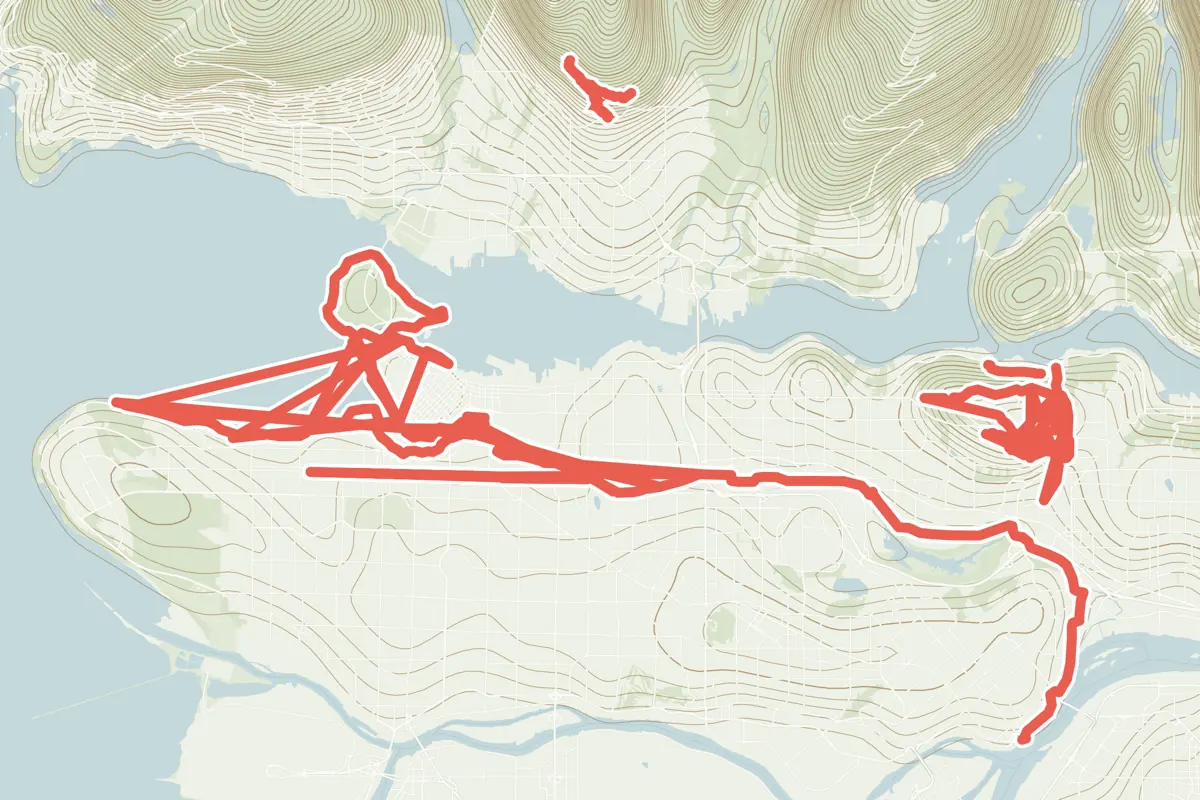
First come rides Vancouver is known for: Seaside Greenway, 31.5 km (19.6 mi); and Central Valley Greenway, 25.1 km (15.6 mi). Of the 8 other tracks around the centre, 5 are for cycling and 3 for mountain bikes. The longest ride or track here is Seaside Greenway, 31.5 km (19.6 mi). Hornby Bikeway runs through the centre itself. Of those of 5 km or more, the hilliest is Mountan Highway, with about 550 m of climb over 9.6 km (5.9 mi), and the flattest Central Valley Greenway, with about 170 m. One long-distance route passes through as well: Trans Canada Trail.
How long
- 7 under 5 km (3 mi)
- 1 of 5 to 20 km (3 to 12 mi)
- 2 over 20 km (12 mi)
How hilly
- Rolling 2
- Hilly 1
By each one’s climb per kilometre: flat under 5 m (26 ft a mile), hilly from 15 m (79 ft a mile). Most climbs are estimated.
Popular rides in Vancouver
Chosen by Cycle Maps among the tracks mapped in OpenStreetMap: rides Vancouver is known for.
- Seaside Greenway Cycling track Rolling 31.5 km (19.6 mi) About 190 m (620 ft) of climb · 720 m (2,362 ft) from the centre
- Central Valley Greenway Cycling track Rolling 25.1 km (15.6 mi) About 170 m (560 ft) of climb · 1.7 km (1.0 mi) from the centre
On the map
Each line is a track; tap one for its name.
Other tracks around Vancouver
- Mountan Highway Mountain-bike track Hilly 9.6 km (5.9 mi) About 550 m (1,800 ft) of climb · 9.2 km (5.7 mi) from the centre
- Pacific Bikeway Cycling track 4.2 km (2.6 mi) About 40 m (130 ft) of climb · 909 m (2,982 ft) from the centre
- Dreamweaver Mountain-bike track 2.3 km (1.4 mi) About 250 m (820 ft) of climb · 8.3 km (5.2 mi) from the centre
- Hornby Bikeway Cycling track 2.1 km (1.3 mi) About 30 m (100 ft) of climb · through the centre
- Richards Bikeway Cycling track 1.8 km (1.1 mi) About 30 m (100 ft) of climb · 352 m (1,155 ft) from the centre
- Dunsmuir Bikeway Cycling track 1.7 km (1.0 mi) About 40 m (130 ft) of climb · 296 m (971 ft) from the centre
- Baden Powell Trail Mountain-bike track 1.5 km (0.9 mi) About 90 m (300 ft) of climb · 8.8 km (5.5 mi) from the centre
- Homer Bikeway Cycling track 1.4 km (0.9 mi) About 30 m (100 ft) of climb · 451 m (1,480 ft) from the centre
Long-distance routes through Vancouver
Lengths and climbs are for the whole route.
About this list
OpenStreetMap has 440 tracks in or near the square searched around Vancouver; this page shows 2 popular rides, 8 tracks and 1 long-distance route. 9 tracks shorter than 1 km are left out. One track under 2 km named for a street is left out. The centre is taken as 49.2827° N, 123.1207° W, and the list was made on 24 October 2026. How the city lists are made.
Cities near Vancouver
- Portland United States · 420 km (261 mi) away
- San Francisco United States · 1,281 km (796 mi) away
- Montreal Canada · 3,686 km (2,291 mi) away
Find tracks anywhere with the app
Cycle Maps is an Android app that finds cycling and mountain-bike tracks near any spot on the map.